Morehead City, NC to Hingham, MA
We had been dealing with Tropical Storm Anna for four days.
The weather at Morehead City Yacht Basin on Saturday morning (May 9) was overcast with light rain and light winds. The big question facing us that morning was whether to run the ICW from Morehead City to Norfolk, stay put and wait out the storm or head out on the Atlantic and try to outrun the storm.
Option 1: Run the intercoastal from Morehead City to Norfolk.
This option has the advantage of the intracoastal's protected waters for a distance of 185 nautical miles, which we would have to do in three segments.
- Morehead to Belhaven: 67 NM
- Belhave to Coinjock: 96 NM
- Coinjock to Norfork 43 NM
Note: The actual distance to the sea in longer than 185 NM. You need to add 27 additional NM to get out to sea making the total distance 211 NM.
However, it comes with three major disadvantages. The first is the Alligator River Swing Bridge. Right you are, a 30 knot wind would close the bridge. The problem is exacerbated by the fact that there is no place to dock between Belhaven and the bridge. We were shut down last year for 6 days when high winds forced closure of the bridge. The second is Currituck Sound which while shallow to start with becomes very shallow when the wind blows out of the northeast. This would definitely be the case with a massive low pressure system to the south and east. The third is a three mile river segment that has 5 feet of water at low tide. Sue Lister, also know affectionately as "the navigator," reported boats being stuck in Coinjock in the last few weeks due to winds and shallow water on Currituck Sound.
Option 2: Stay put in Morehead City or Belhaven:
With Tropical Storm Anna southeast of off the South Carolina coast churning up 50 knots sustained winds with gusts to 60 knots and forecasted to move slowly north northwest and then to turn northeast, which would have put the storm right over the the ICW route from Morehead to Belhaven, it portended a minimum 4 to 5 day layover. On Saturday morning Anna was located at 32.4 N and 77.6 W moving northwest at 3 knots. Maximum sustained winds were 50 knots with gust to 60.
 |
| Tropical Storm Anna |
Option 3: Head out and attempt to outrun the storm;
The Sirus Satellite Weather screen shot below along with the one above provide the big picture. Anna is still over a hundred miles from the coast and moving slowly (3 knots). The morning forecast called for 5 to 7 foot waves with winds 15 to 20 knots along the route from Cape Lookout just outside of Morehead City / Beaufort, to Cape Hatteras, 8 foot waves around Cape Hatteras and then reduced wave heights immediately north of the Cape. The distance to Cape Hatteras is just over 90 NM which translates into 12 plus hours. Five to eight foot waves are no picnic but we've experienced this in the 63 and she can handle it with ease.
 |
| The area of immediate concern. About 90+ nautical miles. |
One critical factor in our decision was the forecasted wave period of 9 seconds around Cape Hatteras. Wave period is the distance between the wave peaks of the highest ones. The longer the period the smoother the ride as the boat rides up, over and down the first wave and then up the second. NOAA was also forecasting a shorter 4 second period on the smaller waves but this was of lesser concern. A shorter wave period on the larger waves results in taking seas over the bow also known as burying the nose.
 |
| Forecast for Cape Hatteras |
Another critical element was wind. The Cape Hatteras forecast called for 15 to 20 knots out of the southeast. Wind produces waves, period! The higher the wind the higher the waves. I considered these winds as favorable, relatively speaking. In the segment from Fort Pierce to Southport we experienced winds between 30 and 40 knots, which ultimately forced as to run in close to the coast in search of smaller seas. The forecasted southeast direction would be in our favor on the run from Cape Fear (Morehead City) to the beginning of Diamond Shoal (Cape Hatteras) as seas would be on the beam. Once we started the 17 NM southeasterly run along the south side of the shoal the winds would be on the nose and would increase as we headed out to sea.
The final critical element in the decision is the status of the boat's systems, machinery and electronics. As of Saturday morning all systems were functions as expected.
The trade off was 12 hours of discomfort about equal to that experienced from Georgetown to Southport followed by rapidly calmer seas just north of Cape Hatteras lasting all the way to New England. Assuming the forecast held and the ship's systems functions as they had and we made no mistakes the risk was, in my opinion, reasonable. A vote was taken and we decided on Option 3.
The Journey:
The first step was getting the boat ready for heavy seas. Over the course of the last two Atlantic coast runs I have learned a few lessons beyond the standard stow everything that could potentially move . Here's a list of our extra preparation for running in heavy seas:
- Position the salon table next to the salon settee
- Place a rubber mat under the salon table (to prevent movement)
- Place cushions at the table posts to prevent damage to the salon settee woodwork
- Place the barrel chair against the table
- Secure all outdoor cabinets with duct tape.
- Remove books from bookshelves in the VIP stateroom
- Place a towel in the wine cooler to prevent movement of the draws
- Lay bottles on their side in the fridge
- Remove the anchor canvas (learned the hard way. We tore out a fastener)
Note: Barometric pressure at the dock was 30.05 inches at departure.
We departed the dock at 5:30 AM and within 10 minutes were heading southeast down the Beaufort Inlet. As expected winds picked up as soon as we left the rather well protected marina. They were coming out of the east at 27 knots. As we headed out Beaufort Inlet to open water the seas quickly built to 5 to 8 on the nose. The good news is the wave period was the predicted 7 to 8 seconds. The ride was OK enough.
By 7:15 AM we were running south and east along Cape Lookout Shoal. We had covered 13 nautical miles. Winds were east at 20 and the barometer was rising (30.07 versus 30.05 at the dock). We estimated waves at 7 to 9 with an occasional 10 to 12 on the starboard bow (head sea). The period between peck waves was 6 seconds. The 10 to 12's get your attention. They appear and are big. The 63 handled them smoothly.
 |
| This is what an 8 to 10 looks like |
At 8:02 AM we crossed the shoal in waters where the depth was 18 to 24 feet. The seas over the shoal were confused and there was breaking surf around us in the shallow water outside of our course. Waves were 5 to 8 with a few big ones mixed in. We never saw less than 10 feet under the keel.
At 8:15 AM we were clear of the reef. The waves were 10 to 12 mostly off the starboard beam. The stabilizers proved their worth. This condition continued until we reached the area off Ocracoke Inlet around 1:30 PM. In this area, which is just southwest of Cape Hatteras, the winds were east southeast at 22 knots with waves heights between 4 to 6. Still a head sea. We were somewhat in the protection of Diamond Shoal which extends south and east 17 miles off of Cape Hatteras and cannot be crossed.
Around 1:00 PM we had lunch, which due to the turbulence consisted of crackers and cheese. Notice the coke in Dick's hands. We needed to hold our drinks to prevent spilling. Everything else stayed put on the rubber matting.
 |
| David and Dick pose with our crackers and cheese "heavy seas" lunch |
At 3:44 PM we began the 17 NM trek out to sea to round Diamond Shoal. Waves continued in the 5 to 7 range off the nose with a tolerable period of 7 seconds (yes I actually count the seconds). Winds were south southeast at 27 knots Barometric pressure was now 30.13 indicating movement away from the low pressure zone. We had covered 80 nautical miles.
 |
| Approaching Cape Hatteras and Diamond Shoal |
At 4:55 PM we turned east for 35 minutes to clear the southeast end of the shoal. Winds were from the southeast at 20 knots. Waves were 4 to 6 on the beam with an occasional 8 to 10.
At 5:30 PM we had rounded the eastern end of Diamond Shoal and turned north to a heading of 6 degrees. The world changed in an instant, We now had a 4 to 6 foot following sea off the starboard aft quarter. Somehow the big waves disappeared, which may have something to do with convergence of the Gulf Stream and the Labrador Current at Cape Hatteras. Winds were noted as southeast at 203 knots. We had now traveled 95 nautical miles and had been on the water for 12 hours. Our average speed since leaving the dock was 8.1 knots. Barometric pressure was 30.15.
Now to the weather. The screen shot below shows
Guided Discovery about to head out to sea along Diamond Shoal and into an area of rain that ranged from light (green) to moderate (yellow) to heavy (red). Dick predicted that the heavier storm cells would pass before we arrived.
I was less optimistic. His prediction proved correct. We experienced light rain.
 |
| We encounter rain as we round Diamond Shoal |
As of 5:00 PM EDT, Tropical Storm Anna was still off the South Carolina Coast (32.9 N, 78.3 W) moving northwest at 3 knots. Maximum sustained winds were 50 knots with gusts to 60. Notice in the photo below the orange storm symbol. It marks the eye of a tropical storm or hurricane. Notice also that the bands of rain are predominantly in the northeast quarter of the storm and that the storm is still offshore. We are in an outer band of rain with some small heavy cells approximately 150 nautical miles northeast (i.e., in the upper right side of the photo). Anna is not a threat now or in the coming hours as she has to move on shore before turning northeast to run toward Cape Hatteras and then out to sea to head north along the east coast.
 |
| Our position relative to Tropical Storm Anna |
The sunset at 8:08 PM and the light failed shortly after civil twilight at 8:38 PM. It was lovely. Besides catching a lovely sunset, I recorded the following data in my cruising log. Winds ESE at 14 knots, barometer 30.17 and seas 3 to 4 feet of the starboard aft quarter. In three hours, the seas and winds had dropped to where the ride was very pleasant. We had now traveled 121 nautical miles.
 |
| Sunset three hours after rounding Diamond Shoal off Cape Hatteras |
We continued on through the night running up the coast along North Carolina's Outer Banks as winds and seas continued to diminish. Dick recorded winds at 9 knots out of the southeast at 2:39 AM and 2 to 3 foot seas on Sunday morning.
 |
| Sunrise on Sunday morning with calm seas |
At 6:39 AM and 200 NM into the trip we were abreast of Cape Henry. This is significant. We had been traveling for 25 hours and were off of Virginia Beach. Twelve of those hours were in heavy seas, 13 were on calming waters that were now flat. Had we stayed in Morehead City the storm would still be south and east of us.
We crossed the Chesapeake Bay shipping channel on Sunday morning and made our way toward Cape May passing Ocean City Maryland early Sunday evening (around 7:00 PM). A check of the weather at 5:17 PM showed that Anna was now a tropical depression moving NNE at 7 knots. That put the storm in the Southport Cape Fear area. Winds had diminished from 50 with gusts to 60 to 30 with gusts to 45. She was starting to chase us but we were better than 250 miles north and moving slightly (1 knot) faster. The only question now is whether the storm would accelerate and catch up. NOAA's forecasts said this would not be the case.
Dinner on Sunday evening was a fine filet from Allen Brothers cooked on the grill, which as you know is on the boat deck. Fixings included garlic and herb de provence potatoes baked in the oven and a salad with tomatoes, avacado, pine nuts, walnuts and raisins. The meal was accompanied by a fine 2011 Sequoia Grove Napa Valley Cabernet.
We reached Cape May around 11:00 PM on Sunday night. Winds were out of the southwest at 5 knots, the temperature was 59 degrees and the barometer was 30,22 inches (as compared to 30.05 at the start of the trip). Waves were less than 2 feet. Visibility had dropped to less than a mile. Tropical Depression Anna was now 237 NM behind us at Cape Hatteras.
We passed Atlantic City at 2:34 AM on Monday and continued north toward Sandy Hook and the New York shipping channels. As we approached New York we changed to a more northeasterly course and headed direct to Fire Island on calm water. This course put us about 30 NM out to sea and avoided the congestion at the shipping channels that converge at the entrance to New York harbor.
Now we were cruising along the south coast of Long Island. As we proceeded northeast fog began to set in reducing visibility. In the vicinity of Shinnecock Reef at 5:44 PM we began to encounter fish trap markers. They were all over the place and the were difficult to see due to the fog. Readers may recall that I encountered fish trap markers a year ago in the same area. The difference this time was that I had night vision in addition to radar.
 |
| Hard to see fish trap marker in the fog off Shinnecock Inlet |
We were abreast of Montauk Point (the furthest eastern point of Long Island) at 9:25 PM and then passed Block Island (RI) at 11:33 PM. Throughout the night we were in 2 to 3 foot seas with zero visibility. The combination of AIS, radar and night vision made this segment quite manageable. As we passed Block Island we had covered a total of 544 nautical miles since leaving Morehead City.
 |
| Tropical Storm Anna at 3:00 AM on Tuesday |
Early in the morning (1:32 AM) AIS and radar showed a target directly ahead 5.2 NM on our course line. AIS said it was the tug Neptune towing a barge with 200 feet of cable between the two vessels. Neptune was traveling 6.2 knots on a heading of 70 degrees. Our heading of 067 degrees showed a potential collision. However, at our then average speed of 8.3 knots we had plenty of time (2.5 hours) to wait before taking evasive action and we were in communication. Ultimately evasive action was not needed as the tug at 3:00 AM continued on a course off of the shipping channel toward its New Bedford destination.
 |
| Tug Neptune changes course |
NOAA had issued a fog warning for the area just east of Montauk Point that encompassed the coast of Rhode Island and Massachusetts including the Cape Cod Canal. The question then arose as to whether we would be allowed to transit the canal in zero visibility. The question had to parts. Could we navigate safely in zero visibility and was it legal for us to proceed. Both answer were favorable. The canal is wide enough to permit navigation using a GPS controlled route and pleasure craft are allowed transit if the have radar. Canal Control dictates whether commercial traffic can transit.
 |
| Transiting the canal on autopilot |
We arrived at the Cape Cod Canal at 5:38 AM with visibility of 1/4 mile, which is more than adequate. Still we activated the programmed route and transited the canal on autopilot. The route worked perfectly. The only "bad" news was the current which was running against us at 4.1 knots. We increase power to 1600 RPM and recorded a speed of 5.2 knots.
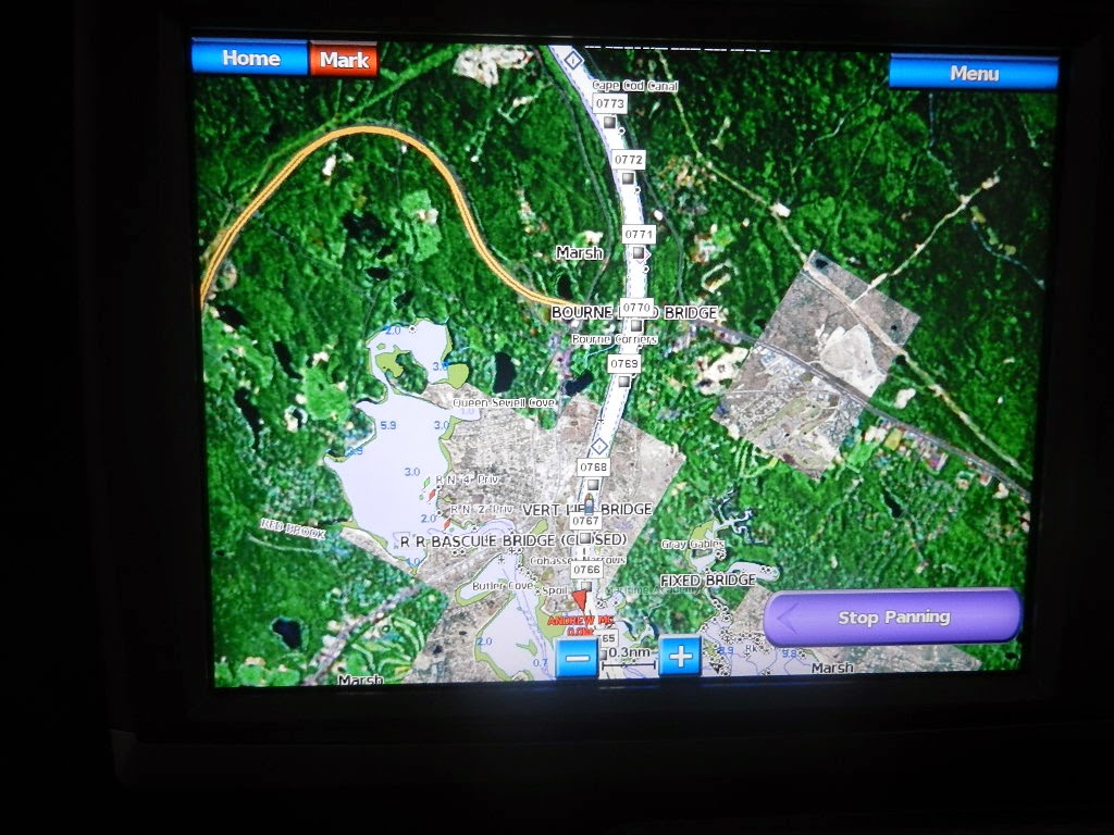
 |
| Cape Cod Canal Railroad Bridge (at the west end of the canal) |
The 5 hour run from the Cape Cod Canal to Hingham was easy. Visibility continued at 1/4 mile or better and the seas were under 2 feet. We passed the time dodging lobster pots (i.e., trap markers) which are quite prevalent in this stretch and practiced spotting them using night vision. Time goes fast (which shows essentially the same picture during the day as at night). We arrived at:
- East end of the Cape Cod Canal: 7:24 AM
- Plymouth Light at 9:08 AM
- Marshfield at 9:46 AM
- Situate at 10:46 AM
- Cohasset at 11:16 AM
- Boston Light at 12:02 PM
- Hull Gut at 12:18 PM
- Hingham Shipyard Marinas at 12:46 PM
 |
| Minots Light visible on night vision |
 |
| Minots light looking out the window and seeing it on night vision |
 |
| Boston Light. We're less than 30 minutes from "home." |
 |
Arriving at Hingham Shipyard Marinas at DEAD low tide
Remnants of the WWII shipyard ways are visible in this photo |
Diana and Kodi were at the fuel dock for our arrival at 12:50 PM. All that was needed was to take on fuel (763.8 gallons at $2.99/gallon) and move to the T-dock of I, our home for the summer.
 |
| Dick and Les with Guided Discovery in her "permanent" slip on the T of I-dock |
Statistics:
- Leg Distance: 652 Nautical miles
- Engine Fuel Used: 696 gallons of diesel per Cat engine monitors
- Time Enroute: 79 hours and 37 minutes
- Total Distance: 1,237.6 nautical miles since leaving Fort Pierce
- Total Distance: 1,456.3 nautical miles since leaving Sarasota
- Total Fuel Since Leaving Fort Pierce: 1,533.2 gallons
- Fuel Added: 763.8 gallons
- Fuel Price: $2.99 per gallon
- Fuel Cost: $2,283.76
- Total Cost to move from Sarasota to Hingham: $8,303
David departed for Albany in an Enterprise rental minutes after we landed. Diana, Dick and I adjorned to Alma Nove for a late lunch where we had the pleasure of meeting Alma (mother of Mark Wahlberg) for whom the restaurant is named.
 |
| Dick and Les at Alma Nove |
Written by Les.