Sunday, October 25, 2015

Hingham Adventures: Peddlocks Island

Lesley, Amelia and I continued our island adventures with a visit to Peddocks Island in late August, again in search of monarch eggs.


Peddocks lies across Hull Gut and the Pemberton neighborhood of Hull to the north and across West Gut to Nut Island and Hough's Neck to the west. The island is one of the larger islands in Boston Harbor at 210.4 acres and has the longest island shoreline. Peddocks Island comprises four headlands connected by gravel or sand bars known as tombolos.

Peddocks Island looking northeast into Hull Bay
Hull Gut is to the left. The West Gut and Hough's Neck is to the right

Looking east across Hull Gut to Pemberton Point
Peddocks is One of many Boston Harbor Islands that was inhabited by Native Americans prior to European settlement in America and was was primarily used for farming since 1634. Its closeness to mainland Boston enabled its use for military purposes as well. During the Revolutionary War more than 600 militiamen were stationed on the island to guard against the return of British troops following their evacuation of Boston by the hand of Gen. George Washington on March 17, 1776. A patriot infantrymen's raid on a Loyalist (Tory) farm is also believed to have taken place on the island.[4]

In 1904, Fort Andrews was built on the island, and it served as an active harbor defense fort until the end of WWII. As of 2008, 26 of the original buildings of Fort Andrews were still standing — guardhouses, prisoner-of-war barracks, stables, a gymnasium, a firehouse, etc. — although most of them were in decrepit shape and were closed to the public for safety reasons.

It is still inhabited today although by only 17 people.  The island has no electricity or running water.  We met one of the residents and he told us that theState of Massachusetts had deliberately destroyed a water main that ran to the island from Hough's Neck in an attempt to force residents off the island. According to his account, the State nearly succeeded but was prevented from evicting the residents due to the manner in which titled had been conveyed to the properties.

Lesley, Amelia and I walked from one end of the island to the other by the central path that connects the headlands.  Then we walked back along the northeast shoreline.  In total we walked over 3 miles. I'll let the photos tell the story.

A building from Fort Andrews with parade field to the left
A photo showing a now demolished building and the one in the above photo

Our dingy anchored off the ferry dock


Stairs leading to a camp ground on the drumlin

Cicada

One of the houses on the island


View of the west headland with cottages visibile

Houses on the west side of the islands.  Some in very good shape

Yes, they really have out houses.  No running water


Long abandoned cottage


Rain barrel to collect water


Remnants of a dock

One of the island's 17 residents


View of the Ranger station


National Park Service Rangers

Historic photos


Lesley captures me pulling up the anchor
We had a great visit but alas, we did not find a single monarch egg. We will definitely return next summer.

Written by Les.


Hingham Adventures: Spectacle Island

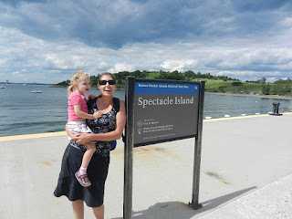
We made three visits to Spectacle Island this summer, one by dingy and two with the 63.  


Spectacle Island is located about 6 miles west of Hingham in Boston Harbor.  Our first visit in late July was by dingy and was made possible by a relatively calm day.  Note: Hingham Shipyard Marina is located in the lower right corner of the map below.  


Spectacle Island as viewed from the east
 A little history (borrowed from Wikipedia). 

Starting in the early 19th century, the island was used exclusively for its relative remoteness from Boston. Two hotels were built in 1847, only to be closed by police ten years later when it was discovered they were used for gambling and other illicit activities.


A horse rendering plant was built on Spectacle Island in 1857, followed by a city trash incinerator that remained active until 1935. When the incinerator closed, trash was simply dumped on the island for the next thirty years. The island remained a smelly, leaking dump until the 1990s.
Then came the Big Dig.  


More history.  Officially known as the Central Artery/Tunnel Project, it was the most expensive (2.8 billion in 1982) road project in the history of the US that rerouted Interstate 93 (known by locals as "the Southeast Distressway, the world's largest parking lot") and the chief highway through the heart of the city. The project also included the construction of the Ted Williams Tunnel extending Interstate 90 to Logan Airport, the Bunker Hill Memorial Bridge over the Charles River and the Rose Kennedy Greenway in the space vacated by the previous I-93 elevated roadway.  The Big Dig transformed the Boston Water front and created a major construction boom in South Boston.

US National Park Facility
Informative displays dealing with the Spectacle Island and the glaciers that formed the Boston Harbor Islands
The Big Dig also transformed Spectacle island as it was here that 4,400 barges of excavated dirt (3.7 million cubic yards) was used as landfill.  The process took 5 years.  When it was completed, the landfill was capped, preventing garbage from leaking into Boston Harbor, and 60 feet had been added to the north and south drumlins.  What had been a source of pollution was turned into a spectacular island park.  Boston Harbor Cruises (BHC) has regular service to Spectacle Island from Boston.

Map showing the walking paths 
Marina at Spectacle Island with the AB RIB tied to the dock


On our July visit Lesley, Amelia and I walked up the north drumlin which rises 170 feet above seal level and provides a spectacular view of Logan Airport, South Boston, President Roads (the main channel to Boston Harbor) and the surrounding islands (Thompson, Long and Deer).  On a clear day you can see all they way to Salem, which is 16 miles north of Boston.

Beautiful walking paths

Logan International Airport as viewed from the north drumlin

View of South Boston
 
President Roads is the main channel into Boston

Looking southeast at the marina from the north drumlin

Looking east to the south drumlin


Lesley and Amelia looking for monarch eggs
 
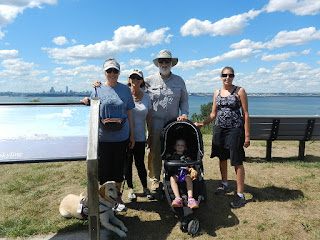
Lesley and Amelia with Boston to the west
Our island adventures, which started as quest to find monarch eggs, and had up to this point included Grape and Bumpkin, did not result in finding any on Spectacle.  However, the visit opened a door to a great local boating destination.  This resulted in two more visits with the 63.  The first was on August 21.

The 63 approaching the remnants of the Long Island Bridge
Boston is to the left and Spectacle Island is to the right

The 63 docked at the Spectacle Island Marina
 
Darrel Peters & Sue Lister joined us on this journey

Along with Diana, Lesley, Amelia and the Furry Kid (Kodi)

Looking southeast from the north drumlin at the 63 docked at the marina along with the BHC ferry

The crew poses for a photo at the top of the north drumlin with Boston in the background
 The final visit occurred on a beautiful September afternoon.  This visit included walks up both the north and south drumlins.

Skip and Jan at the helm on the way to Spectacle Island

Lesley and Amelia

Mike and Sue joined us with Brady, their 6 year old yellow lab (Kodi's buddy)

Diana with Betsy (Dick Singer's sister who lives in Hull)

The 63 docked at Spectacle Island Marina as viewed from the south drumlin
 Written by Les.