Note to followers: We have had great difficulty uploading photos since leaving Grand Harbor Marina, which, of course, is due to the incredibly poor air card reception. We will eventually catch up.
Synopsis: In two days we traversed 7 locks and dropped 257 feet to our present elevation of 163 feet above sea level and covered 77 miles. Running time was just short of 11 hours to our present destination.
Here's the details:
We departed Bay Springs Marina in New Site with our friends, Darryl and Sue of Present Moment and Dave and Bill of the River Cities condo barge at 7:45 AM and proceeded to the Whitten Lock, the first one on the Tennessee Tombigbee Waterway.
Thanks to Sue's call to the lockmaster, the lock was ready. The Whitten Lock has a lift (drop) of 84 feet, which makes it the 9th highest lift in the US. We filed in and secured to floating bollards.
Photo 3901
Photo 3895
Photo 4594
23 minutes later the doors opened and we departed the lock. While just a bit hard to see, the photo below shows the grooves in the lock wall that are 5 feet apart. These help you gauge your progress going down. Note: While the drop is substantial, this lock was far easier than the Pickwick Lock where we were going up. When descending you do not experience the pressure of the water filling the lock which pushes the boats to the wall.
Photo PB10123
17 minutes later we arrived at the Montgomery Lock (30 foot lift) and entered the lock after a brief 18 minute delay. This lock would also have been characterized as uneventful if I had not lost my portable VHF ($200 to replace) which fell off my belt while I was securing the line to the bollard. The loss of the portable was slightly more than an inconvenience. The portable allowed me to monitor two channels and was helpful at times when boats we were calling had reported difficulty with the quality of transmissions from our primary VHF (a Raymarine 240 that has never worked very well).
Photo 4605 (Caption: We could see the river 30 feet below as we tied to the wall)
At 10:52 AM, our transponder) a tow, the Kay Templeton, ahead preparing to enter John Rankin Lock and our group of three boats slowed to idle speed. 13 minutes later we arrived at the lock and then waited almost an hour for the Kay Templeton to lock through. Once the lock was ready, we entered and after a 13 minutes and a drop of 30 feet were on our way.
Unfortunately, we were headed to another delay at the Fulton Lock, which is only 7.3 miles from the Rankin Lock. Here's why. Commercial vessels have priority over pleasure craft. So even if we were able to overtake the Kay Templeton, we would have been delayed if he was within 30 minutes of the lock.
I called the Kay Templeton on the VHF and asked if he would allow us to pass. He was a VERY good sport and agreed to let us lock through if the lockmaster would allow him to tie up to the lock (approach) wall if he got there while we were descending. The lockmaster went out of his way to remind the Kay Templeton that he had priority. Fortunately, the Captain stuck with his agreement to let us take his slot. He moved over to the right descending bank and allowed us to pass (as the channel is rather narrow).
Unfortunately, the River Cities barge could not take advantage of the "deal" as they can only make 5 MPH. So, they agreed to hang back and let us and Present Moment avoid the delay.
So, at 3:00 PM we were tied up at the Smithville Marina. Had the Captain of the Kay Templeton not been such a good sport we would have arrived closer to dusk, which is when the River Cities barge arrived.
Photo 4610 (Caption: Guided Discovery at the Smithville Marina)
The Smithville Marina was very unique. Run by Jesse Cox and his wife, two lovely folks in the 80s, it was charming although a bit primitive. What stands out is that Jesse sits in a rocking chair on the porch of his office and directs you into the marina over the VHF radio. The primitive part you ask? Besides no services (bathrooms, showers, washers or dryers) we had difficulty hooking up our 50 AMP service next to our boat.
Undaunted, we then attempted to hook up using our Smart Y, which enables to 30 AMP connection to connect with our 50 AMP plug (although limits the amperage to 30). The 30 AMP connections were also problematic with one shorting out and making a disconcerting buzzing sound. Darryl and Sue let us borrow their two 30 AMP cables and we were able to get power from the junction box next to their boat.
We all sat on the porch chatting with Mrs. Cox. Then we borrowed their courtesy car, a 1980s Oldsmobile 4dr sedan. As we drove to the Pete's Steak House, Darryl, who's former profession was a trial lawyer, explained that we were driving in a GM A-body and then went on to explain the poor engineering of the engine mounts that allowed the engines to intrude into the vehicle in a crash. Fortunately, Darryl drove very carefully.
Dinner was unusually good and here too there is a story to tell. Turns out that Smithville is in a dry county (groan), which we learned after the waitress rattled off all the uninteresting beverages we could have while studying the menu. However, they were innovative. She explained they had beer in the cooler and proceeded to bring us three in Styrofoam cups, which was how they got around the law. Good for them.
Thursday morning, we departed Smithville at 7:46 AM and traversed the Wilkins, Amory and Aberdeen locks with no delays. After dropping an additional 82 feet we arrived at our destination, Columbus Mississippi (population 23,818) at 1:25 PM.
The Columbus Marina was built in 1999 and is a modern full service operation. It seems that we have finally caught up with the other Loopers as there were at least 10 of us there. We soon learned that there was to be a Looper gathering under the marina office at 5:00 PM. Sure enough they all gathered but not at five. Seems that Looper are not on "Lombardi Time." We chatted with several Loopers but then had to leave as we had a dinner reservation. I had heard these imprompu gathering occur regularly when a bunch of Loopers are together.
Photo 4620 (Caption: Columbus Marina as viewed from the Tombigbee Waterway)
Note: The prominent building in the photo is a restaurant called Woody's. Woody's sits right on the water and was built with a first class dock to allow boater to cruise to dinner. Unfortunately, Woody's did not make it as evidenced by the For Sale sign on the building.
The marina owner, T Caldwell, suggested Hucks in the historic downtown section where we went in style in their courtesy car, a relatively new Toyota Sedona minivan with 19,000 miles on the odometer. Dinner we really good. Darryl and Sue from Present Moment went to dinner with us. We all had great time.
Photos 4623 and 4624.
Written by Les
Friday, November 12, 2010

Tuesday, November 9, 2010
Now the Tenn-Tom - Day 38 - Iuka to New Site, MS
Technically, we entered the Tennessee Tom-Bigbee Waterway several day ago when we first stayed at Grand Harbor Marina. However, we only explored mile one and then turned north and east for our side trip to Florence.
Today, we began the 449.7 mile journey south to Mobile down the Tenn-Tom, which will involve 12 locks that will lower us some 414 feet to sea level. As usual, the morning began with fog on the river and a long walk with Kodi.
We departed at 9:13 AM with clear skies, unlimited visibility light winds, warming temperature and spectacular scenery as we traveled the six miles stretch to the Divide Cut, a 24 mile man-made canal that connects the Tennessee River to the Tom-Bigbee River.
While scenically uninteresting, it is the vital link that created the Tom-Bigbee Waterway and in doing so eliminated risking life, limb and hull on the treacherous Mississippi (to quote Fred Myers, author of Tenn.-Tom Nitty-Gritty Cruise Guide).
We passed Dave and Bill in the River Cities condo sales barge, who like us were on there way to Bay Springs Marina.
Photo Pending
At 12:47 we departed the Divide Cut and entered Bay Springs Lake, which returned us to beautiful and serene scenery and a perfectly calm lake. An hour later we reached the Whitten Lock and Dam, turn left up an embayment and tied up a Bay Springs Marina.
Photo Pending
Kodi got to swim, do some retrieving and, to her chagrin (and our pleasure) got to endure a bath on the dock.
Photo Pending
This was followed by a late afternoon dingy ride to the Whitten Lock where tomorrow, we will drop down 84 feet. Returning from the lock, we stopped to chat with Darryl and Sue from Present Moment, fellow Loopers who we met in Florence. They joined us later in the evening to share a bottle of Cliff Leeds 2005 Cabernet Savignon, which had been allowed to breath for an hour. It was delicious. Again, we enjoy meeting fellow Loopers and swapping stories. It really is a delightful part of the Great Loop culture.
Written by Les
Today, we began the 449.7 mile journey south to Mobile down the Tenn-Tom, which will involve 12 locks that will lower us some 414 feet to sea level. As usual, the morning began with fog on the river and a long walk with Kodi.
 |
| Fog bank obscuring the Aqua Harbor bay |
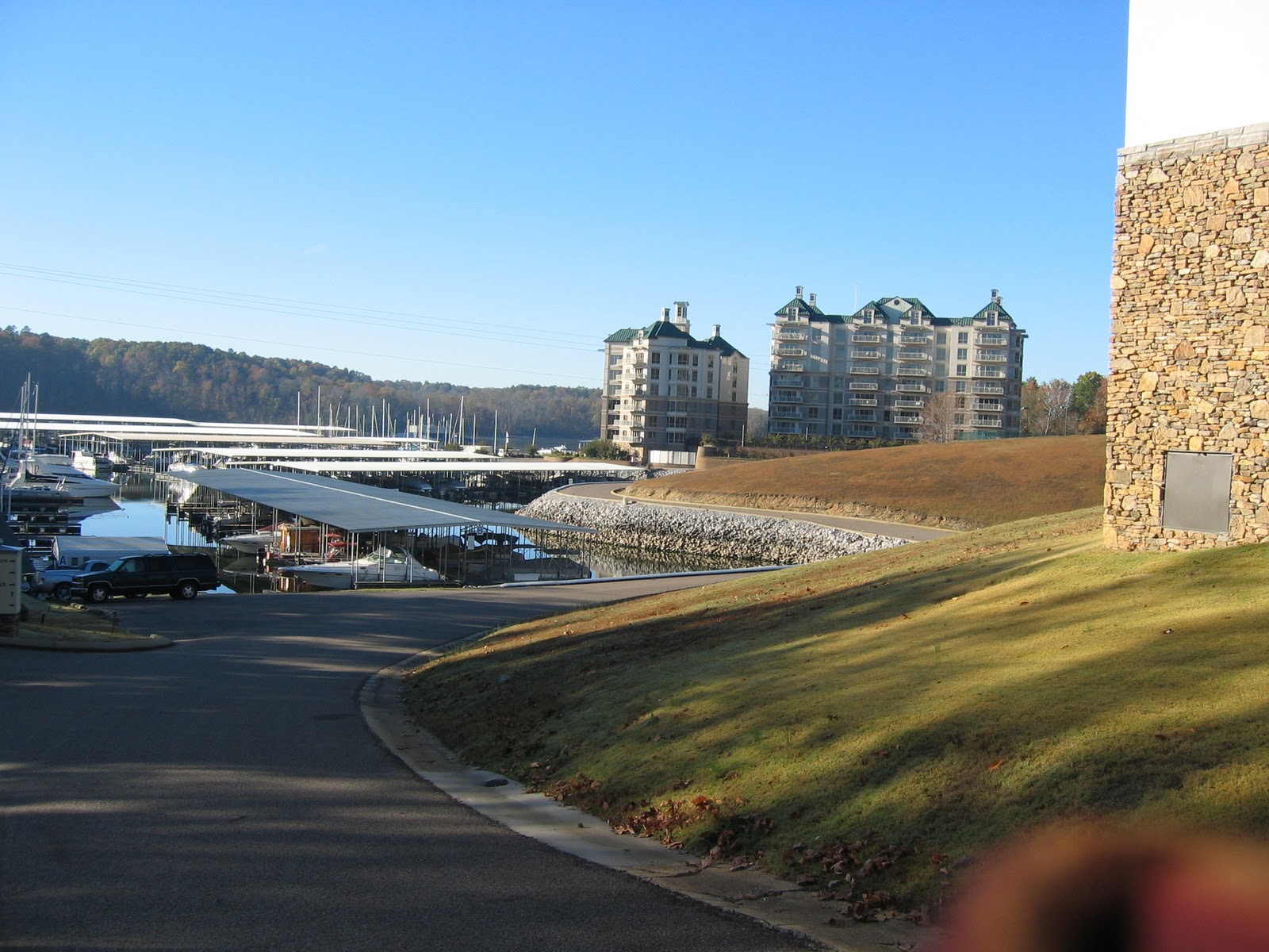 |
| View of Grand Harbor as we completed our walk |
 |
| Rock formation to stern |
While scenically uninteresting, it is the vital link that created the Tom-Bigbee Waterway and in doing so eliminated risking life, limb and hull on the treacherous Mississippi (to quote Fred Myers, author of Tenn.-Tom Nitty-Gritty Cruise Guide).
 |
| Rip Rap along the Divide Cut |
Photo Pending
At 12:47 we departed the Divide Cut and entered Bay Springs Lake, which returned us to beautiful and serene scenery and a perfectly calm lake. An hour later we reached the Whitten Lock and Dam, turn left up an embayment and tied up a Bay Springs Marina.
Photo Pending
Kodi got to swim, do some retrieving and, to her chagrin (and our pleasure) got to endure a bath on the dock.
Photo Pending
This was followed by a late afternoon dingy ride to the Whitten Lock where tomorrow, we will drop down 84 feet. Returning from the lock, we stopped to chat with Darryl and Sue from Present Moment, fellow Loopers who we met in Florence. They joined us later in the evening to share a bottle of Cliff Leeds 2005 Cabernet Savignon, which had been allowed to breath for an hour. It was delicious. Again, we enjoy meeting fellow Loopers and swapping stories. It really is a delightful part of the Great Loop culture.
Written by Les
Monday, November 8, 2010
Adventures in Florence (not Italy) - Days 35-37 - Florence, AL
First, I'd like to say how much we enjoy and appreciate emails, comments and support from friends. So to all of you who have followed our successes and foibles, thank you. Staying connected means a lot to both of us.
Our friend Mike Maglione suggested we visit Florence, and we are glad that we did. With a population of 38,000 it seems like a big city after Hoppies, etc. We probably like it so much because we can stock up on things that we can find in Chicago, i.e., after a dry spell, Les was thrilled to find a store that sold Le Croix. (Les drinks 3 or 4 a day with lime.)
Florence is also along the beautiful Tennessee River, which is a pleasure to see every morning. There is a rythym to the day .. the fog hangs heavily over the river in the early morning, then burns off to sunny skies, and ends with gorgeous sunsets over the river.
Lisa C. suggested reading Mark Twain's Life on the Mississippi as we cruise along, and it is indeed a wonderful companion to traveling the river systems. M. T. has actually helped me to think about "reading the water", navigating around shoals, etc. He found a romance in it that is rather contagious.
Both Saturday and Sunday the marina let us use the courtesy car. We went to Pope's Tavern which was once a real tavern, but later used as a field hospital during the Civil War. Florence has the distinction of having changed hands 40 times during the war. They had some neat stuff inside. Les loves all the Civil War history. One of our boat mechanics (we've had a few!) told us that you can still find mini balls in fields.
Photo Pending
Then we went to a Frank Lloyd Wright house that was commissioned in 1940, the Rosenbaum house. While we've seen many FLW homes over the years, this one was occupied by its' original owner until 10 years ago when the city purchased it. Therefore, it is mostly original. The woman who gave the tour knew Mrs. Rosenbaum, which made it more personal.
Photo Pending
Catfish seems to be the predominant item on most menus these days, but we were able to find a good Italian restaurant. We missed the UNA football game Sat. night at the stadium - OMG - it was 30 degrees!
We've noticed a few other local things, such as the number of pick up trucks. I hear they call them "Mississippi Cadillacs".
Having enjoyed our stay in Florence, Monday we headed back to Grand Harbor to start our trip down the Tennessee Tenn-Tom Bigbee on Tuesday. I'm crossing my fingers that we won't have to anchor out more than once. We'll keep you posted.
Photo Pending
P.S. After all these years, I am finally able to remember how many s's and p's are in Mississippi and the same for all the e's and n's and s's in Tennessee. (I wonder if they have trouble spelling Illinois!)
Written by Diana
Our friend Mike Maglione suggested we visit Florence, and we are glad that we did. With a population of 38,000 it seems like a big city after Hoppies, etc. We probably like it so much because we can stock up on things that we can find in Chicago, i.e., after a dry spell, Les was thrilled to find a store that sold Le Croix. (Les drinks 3 or 4 a day with lime.)
Florence is also along the beautiful Tennessee River, which is a pleasure to see every morning. There is a rythym to the day .. the fog hangs heavily over the river in the early morning, then burns off to sunny skies, and ends with gorgeous sunsets over the river.
Lisa C. suggested reading Mark Twain's Life on the Mississippi as we cruise along, and it is indeed a wonderful companion to traveling the river systems. M. T. has actually helped me to think about "reading the water", navigating around shoals, etc. He found a romance in it that is rather contagious.
Both Saturday and Sunday the marina let us use the courtesy car. We went to Pope's Tavern which was once a real tavern, but later used as a field hospital during the Civil War. Florence has the distinction of having changed hands 40 times during the war. They had some neat stuff inside. Les loves all the Civil War history. One of our boat mechanics (we've had a few!) told us that you can still find mini balls in fields.
Photo Pending
Then we went to a Frank Lloyd Wright house that was commissioned in 1940, the Rosenbaum house. While we've seen many FLW homes over the years, this one was occupied by its' original owner until 10 years ago when the city purchased it. Therefore, it is mostly original. The woman who gave the tour knew Mrs. Rosenbaum, which made it more personal.
Photo Pending
Catfish seems to be the predominant item on most menus these days, but we were able to find a good Italian restaurant. We missed the UNA football game Sat. night at the stadium - OMG - it was 30 degrees!
We've noticed a few other local things, such as the number of pick up trucks. I hear they call them "Mississippi Cadillacs".
Having enjoyed our stay in Florence, Monday we headed back to Grand Harbor to start our trip down the Tennessee Tenn-Tom Bigbee on Tuesday. I'm crossing my fingers that we won't have to anchor out more than once. We'll keep you posted.
Photo Pending
P.S. After all these years, I am finally able to remember how many s's and p's are in Mississippi and the same for all the e's and n's and s's in Tennessee. (I wonder if they have trouble spelling Illinois!)
Written by Diana
Friday, November 5, 2010
We take our first side trip - Day 34 - Iuka, MS to Florence, AL
At the suggestion of our friend, Mike Maglione, we decided to visit Florence, home of the University of Northern Alabama and a city of 38,000. This is clearly a side trip as we will have to retrace our course back to Grand Harbor to continue our trip to Mobile bay.
We departed Grand Harbor at Friday 9:30 AM turned north for one mile on the Tenn-Tom Waterway and then east to cruise 40 miles up river to Florence. The weather this morning was partly cloudy with winds out of the northwest at 10 to 15 and a temperature in the low 50s. We proceeded up the Tennessee (also known as Pickwick Lake) with a two foot following sea. It is always amazing to see how quickly wind can build up waves in open stretches of water.
The Tennessee River continued to be beautiful with mostly wilderness along its banks, no debris and a well marked channel. The only thing we could possible complain about is the current, which required us to increase RPMs to maintain our desired 10 MPH cruising speed (and burn more fuel). Of course the good news is that we will burn less fuel when the current pushes us downstream.
As we approached Florence the wilderness was replaced by homes, barge facilities and a TVA powerplant.
After a pleasant four hours we arrived at the Florence Harbor Marina and parked behind an unusual barge, which we soon learned was the sales office for a traveling home on the water.
At the marina office we met Dave, the developer of River Cities and his associate, Bill, who identified himself as a major investor. They are selling a unique concept; a home on a self propelled barge that will travel the inland waterways stopping at cities along they way on an annual 10,700 mile rotation. The goal, which is similar to the Great Loop strategy, is to spend winters in the south and summers in the north. Two pictures essentially tell the story. The complete story is on their website; http://www.rivercitiescondos.com/.
After touring their floating sales office, which was very nice, we walked into Florence's historic downtown, a distance of approximately 1 mile. Note: Florence is the second major city that we have visited thus far. Alton, Illinois was the first. Note: After 34 days a city of 38,000 seems mighty big. My how one's perspective changes.
Then on to the University of Northern Alabama's campus which we spent the afternoon touring. We probably walked 5 miles or more. The temperature was fallish in the low 50s.

One restaurant on our downtown tour has a clever sign in its foyer. We intend to have dinner there tomorrow.


The temperature at midnight was 36.0 degrees when I took Kodi for her evening walk. We are getting a little taste of fall and Diana is thrilled.
Written by Les
We departed Grand Harbor at Friday 9:30 AM turned north for one mile on the Tenn-Tom Waterway and then east to cruise 40 miles up river to Florence. The weather this morning was partly cloudy with winds out of the northwest at 10 to 15 and a temperature in the low 50s. We proceeded up the Tennessee (also known as Pickwick Lake) with a two foot following sea. It is always amazing to see how quickly wind can build up waves in open stretches of water.
The Tennessee River continued to be beautiful with mostly wilderness along its banks, no debris and a well marked channel. The only thing we could possible complain about is the current, which required us to increase RPMs to maintain our desired 10 MPH cruising speed (and burn more fuel). Of course the good news is that we will burn less fuel when the current pushes us downstream.
As we approached Florence the wilderness was replaced by homes, barge facilities and a TVA powerplant.
 |
| Typical scenery as we proceeded up river |
 |
| Homes along the river |
 |
| TVA coal fired powerplant |
After a pleasant four hours we arrived at the Florence Harbor Marina and parked behind an unusual barge, which we soon learned was the sales office for a traveling home on the water.
 |
| Guided Discovery at Florence Harbor Marina |
 |
| River Cities condominium barge |
 |
| Destinations representing 10,700 miles of cruising |
Then on to the University of Northern Alabama's campus which we spent the afternoon touring. We probably walked 5 miles or more. The temperature was fallish in the low 50s.

 |
| Entering the quad |
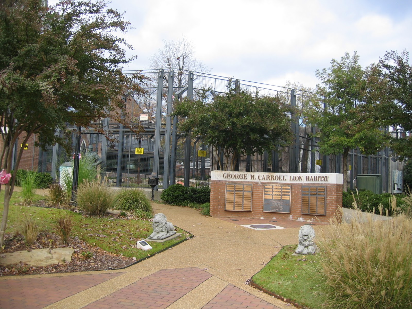 |
| UNA's mascot is a lion. They keep live ones on the campus |


The temperature at midnight was 36.0 degrees when I took Kodi for her evening walk. We are getting a little taste of fall and Diana is thrilled.
Written by Les
Shiloh - Day 33 - Savannah, TN
Thursday we spent most of the day at Shiloh, which we had passed several days ago on the Tennessee River.
The two day battle that took place here on April 6-7, 1862 resulted in 23,746 casualties making it the 6th bloodiest battle of the Civil War. It was also a strategic victory for the Union forces that eventually gave them control a month later of an important rail head at Corinth, MS. Shiloh, which paradoxically means "place of peace," is also cited as the battle that caused Americans on both sides to realize that this was going to be a long and bloody war.
The park, officially called Shiloh National Military Park, is in itself extraordinary; 4,000 acres with 14 miles of roads preserved to the extent possible like it was on the day of the battle. Equally impressive is the signage that enables you to visualize that battle as it progressed. Outside the Visitor Center are five plaques (see photo below). The first three explain the forces arrayed including casualties. The fourth, and largest explain how to visualize the placement of the forces. The fifth deals with Congressional Act that facilitated the park's amazing preservation.
Note: Casualties included killed, wounded and missing. Civil War casualties are often mistakenly cited as the number killed. At Shiloh this number was around 4,000 as stated on the explanatory plaques.
There are 229 original civil war cannons, which due to my National Guard service as an artillery officer are always of special interest.

At Shiloh, Brigadier General Ruggles arrayed 62 cannon on the first day of battle to neutralize a powerful Union position called the Hornets Nest. This was the greatest number of cannons seen on an American battlefield up to that time. Their use enabled the Confederates to capture the 2,200 Union soldiers leading them to believe that they were going to be victorious. The reality turned out to be just the opposite. The brave troops who held that position enabled General U.S. Grant to build strength for attack the following day that drove the Confederates from the field.

Piled cannon balls are also used to mark to headquarters of the general officers.
One of these particularly markers is particularly significant as it marks the site where General Albert Sidney Johnston died. Johnston was commander of the Confederate troops at Shiloh and the highest ranking American officer to die in combat.


The Shiloh battle is so immense and involved that it would be fruitless to for me to try to explain it. That said, the Confederate Memorial did an extraordinary job of symbolically explaining the battle from the Confederate viewpoint. The link is worth reading.
We took lots of photos. Click here to see what we saw.
Post Script: Speaking of battles, we had one the day before when the technician from Aqua Yacht Harbor replaced the AC water and bilge pumps. A simple job was made difficult and time consuming by Sea Ray's marine architects who design boats without regard for the repairs that will most certainly be needed as the boat is used. It took three hours to replace the pumps. Better than half the time was spent removing the batteries and the battery mount to get at the pumps. Total cost: $1,082 including parts and labor.
Special event: I used the Caribe RIB (dingy) to speed over to Aqua Yacht Harbor at 25 miles per hour on a flat lake to obtain a plastic hose connection that was inadvertly broken as the technician reinstalled the water pump. Great fun despite the light rain at the time.
Good news: We fixed the problem during a very rainy day.
Weather Summary: Rainy days: 5. Sunny days: 29.
Written by Les (next day)
 |
| Looking North on the Tennessee as viewed from Shiloh |
The park, officially called Shiloh National Military Park, is in itself extraordinary; 4,000 acres with 14 miles of roads preserved to the extent possible like it was on the day of the battle. Equally impressive is the signage that enables you to visualize that battle as it progressed. Outside the Visitor Center are five plaques (see photo below). The first three explain the forces arrayed including casualties. The fourth, and largest explain how to visualize the placement of the forces. The fifth deals with Congressional Act that facilitated the park's amazing preservation.
 |
| Visitor Center with helpful explanatory plaques |
There are 229 original civil war cannons, which due to my National Guard service as an artillery officer are always of special interest.

At Shiloh, Brigadier General Ruggles arrayed 62 cannon on the first day of battle to neutralize a powerful Union position called the Hornets Nest. This was the greatest number of cannons seen on an American battlefield up to that time. Their use enabled the Confederates to capture the 2,200 Union soldiers leading them to believe that they were going to be victorious. The reality turned out to be just the opposite. The brave troops who held that position enabled General U.S. Grant to build strength for attack the following day that drove the Confederates from the field.

Piled cannon balls are also used to mark to headquarters of the general officers.
 |
| Diana and Kodi |


 |
| Confederate Memorial |
Post Script: Speaking of battles, we had one the day before when the technician from Aqua Yacht Harbor replaced the AC water and bilge pumps. A simple job was made difficult and time consuming by Sea Ray's marine architects who design boats without regard for the repairs that will most certainly be needed as the boat is used. It took three hours to replace the pumps. Better than half the time was spent removing the batteries and the battery mount to get at the pumps. Total cost: $1,082 including parts and labor.
Special event: I used the Caribe RIB (dingy) to speed over to Aqua Yacht Harbor at 25 miles per hour on a flat lake to obtain a plastic hose connection that was inadvertly broken as the technician reinstalled the water pump. Great fun despite the light rain at the time.
Good news: We fixed the problem during a very rainy day.
Weather Summary: Rainy days: 5. Sunny days: 29.
 |
| Pumps located under removed battery box |
Tuesday, November 2, 2010
Electronics Matters - Day 31 - Grand Harbor Marina, Luca, MS
Two failures occurred recently that impacted our ability to efficiently navigate with our the electronics at the helm.
So that you can appreciate the progress we made, I will first explain the state of the art electronics package and then speak to the problems that had to be solved.
The photo below shows the complete electronics display. Starting from the right, just above the helm, and moving from right to left is the Raymarine E120, the Sea Navigator II, the autopilot and the SmartCraft. Above the navigation devices are the engine instruments consisting of a tachometers and gauge package (temperature, oil pressure, voltages) for each engine. Above that, at the center of the panel, is the compass.
The Raymarine E120 is a multi-function display unit. Ours has five functionalities: GPS, chartplotter, Sirius Satellite Weather, AIS (a transponder) and a fishfinder. The photo below shows one of the five "pages" (i.e., screens) and, for us, the key page that displays all five at once. On the left side of the page is our GPS position displayed on a representation of a nautical chart (i.e., vector chart). While difficult to see, the small triangle at the center of the chart is a transponder return of a downbound tow, which tells us the boat's name, location, heading, speed and lots more including a discreet VHF phone number (MMSI). In the upper right quadrant is the Sirius Satellite Weather System and below that is the fishfinder, which in shows in addition to fish, the depth and the bottom contour. We had this unit installed by the dealer to serve as a back-up GPS/chartplotter. Over the years, we have added all of the other functionality.
The 48 Sundancer came equipped with the Sea Ray Navigator shown in the photo below. This is a Windows based computer featuring touch screen capability. It is our primary navigation device with the capability to display radar data and our GPS position overlayed onto a US Government (NOAA) chart (i.e., raster chart) The ability to see our position on the actual NOAA chart is particularly valuable especially when operating on the inland waterways.

The next photo shows the Raymarine autopilot and the Cummins SmartCraft. The autopilot has the ability to hold a course or correct for wind and current (also know as cross track error - XTE) using data from either the E120 or the Sea Ray Navigator.
The SmartCraft contains multiple pages displaying engine and navigation data. The screen shown in the photo shows RPM, temperature, oil pressure, voltage and fuel flow (GPH) and is the page we use while underway.

Note: All of these devises can do for more than I have described. In fact to describe all the functions would take several pages. Technology overload is also a fair description for these devices. It has taken me several years to use, maybe, 25% of their functionality. Pure technology overload. Perhaps some of you can relate.
In addition to the electronics, we have the paper chart for the area we are traversing, cruising guides open to that section, binoculars and our log book. Why the paper charts you ask? Simple. Electronics, while highly reliable most of the time, can go to failure or, as explained below, be functioning perfectly and still be useless.
The first problem, which I failed to mention earlier, occurred as we entered the Tennessee River. In the flick of an eye, the Sea Ray Navigator became useless as, much to my surprise, it did not have the Tennessee River charts. This was a more of annoyance than a safety issue as we still had the E120. However, I particularly like the Navigator as it displays our GPS position on the NOAA chart in relation to the sailing line (or where you should be in the channel). Without the local chart the unit was useless and we shut it down. Note: In clear weather we do not run our radar.
The second problem occurred after we exited the Pickwick Lock (where we had the challenging locking experience described in yesterday's article). The E120 went into a shut-down/boot up cycle rendering it useless. This problem was caused in 2006 when Skipper Buds improperly wired the unit directly to the engine battery with no circuit breaker or separate switch. Again a note. All other equipment has a switch on the panel in addition to a separate on/off switch on the unit. Unfortunately, if you have the E120 operating when you start the engine it causes an electrical overload that cause the unit to reboot. Not good. Unfortunately, I forgot to shut it down before starting the engines while waiting at the lock. Sure enough, we exited the lock and it went into the reboot cycle. Note: Good things come in bunches, like bananas. So do bad things.
So, just like that we went back 20 years to paper charts and binoculars.
Restoring the E120 required the equivalent of a hard shut-down, which restored the system but lost all of my setting. Fortunately, I remembered how to restore my settings and over the next ten miles brought the E120 back to its normal helpful self.
Restoring the Sea Ray Navigator required getting the missing charts and loading them into the computer. Here another note is required. Sea Ray licensed the Navigator System from Maptech, which for some unknown reason (at least to me), no longer supports it and neither does Sea Ray (shame on them). However, last year I found Mark Pringle of NSI (Navigational Solutions International) who knows the system and provides support. Without Mark, my very expensive unit which had gone to total failure, would have essentially been junk. Mark installed a new solid state hard drive, a new power supply and all (well almost all) of the US Government charts.
So, a quick phone call to Mark and he overnights the missing charts. As soon as they arrived, I called him and he talked me through their installation, which as you will see below was a bit complicated.
They say a picture is worth a thousand words. Let's see. The first photo shows the Navigator loading the charts. You can see the disk package on top of the paper charts and cruising guides. Notice the orange cable, which is supplying 115 volt power to the portable disk drive located just to the right of the helm (see second photo). The disk drive is plugged into a USB port on the panel just below and to the right of the helm (and hard to get at). The cursor control and clickers (left and right) are mounted on the dash at the ten o'clock position just behind the wheel. In effect a full blown windows computer just in separate pieces. Note: We even have a keyboard module (which was not needed for this operation).
The cell phone, shown in the second photo, was in speaker mode so that I could talk to Mark while carrying out each task. The total technology on our boat is really amazing.
So, as of this moment, the full electronics package is fully operational.
Written by Les
So that you can appreciate the progress we made, I will first explain the state of the art electronics package and then speak to the problems that had to be solved.
The photo below shows the complete electronics display. Starting from the right, just above the helm, and moving from right to left is the Raymarine E120, the Sea Navigator II, the autopilot and the SmartCraft. Above the navigation devices are the engine instruments consisting of a tachometers and gauge package (temperature, oil pressure, voltages) for each engine. Above that, at the center of the panel, is the compass.
 |
| Controls at the bridge |
 |
| Raymarine E120 |

The next photo shows the Raymarine autopilot and the Cummins SmartCraft. The autopilot has the ability to hold a course or correct for wind and current (also know as cross track error - XTE) using data from either the E120 or the Sea Ray Navigator.
The SmartCraft contains multiple pages displaying engine and navigation data. The screen shown in the photo shows RPM, temperature, oil pressure, voltage and fuel flow (GPH) and is the page we use while underway.

Note: All of these devises can do for more than I have described. In fact to describe all the functions would take several pages. Technology overload is also a fair description for these devices. It has taken me several years to use, maybe, 25% of their functionality. Pure technology overload. Perhaps some of you can relate.
In addition to the electronics, we have the paper chart for the area we are traversing, cruising guides open to that section, binoculars and our log book. Why the paper charts you ask? Simple. Electronics, while highly reliable most of the time, can go to failure or, as explained below, be functioning perfectly and still be useless.
The first problem, which I failed to mention earlier, occurred as we entered the Tennessee River. In the flick of an eye, the Sea Ray Navigator became useless as, much to my surprise, it did not have the Tennessee River charts. This was a more of annoyance than a safety issue as we still had the E120. However, I particularly like the Navigator as it displays our GPS position on the NOAA chart in relation to the sailing line (or where you should be in the channel). Without the local chart the unit was useless and we shut it down. Note: In clear weather we do not run our radar.
The second problem occurred after we exited the Pickwick Lock (where we had the challenging locking experience described in yesterday's article). The E120 went into a shut-down/boot up cycle rendering it useless. This problem was caused in 2006 when Skipper Buds improperly wired the unit directly to the engine battery with no circuit breaker or separate switch. Again a note. All other equipment has a switch on the panel in addition to a separate on/off switch on the unit. Unfortunately, if you have the E120 operating when you start the engine it causes an electrical overload that cause the unit to reboot. Not good. Unfortunately, I forgot to shut it down before starting the engines while waiting at the lock. Sure enough, we exited the lock and it went into the reboot cycle. Note: Good things come in bunches, like bananas. So do bad things.
So, just like that we went back 20 years to paper charts and binoculars.
Restoring the E120 required the equivalent of a hard shut-down, which restored the system but lost all of my setting. Fortunately, I remembered how to restore my settings and over the next ten miles brought the E120 back to its normal helpful self.
Restoring the Sea Ray Navigator required getting the missing charts and loading them into the computer. Here another note is required. Sea Ray licensed the Navigator System from Maptech, which for some unknown reason (at least to me), no longer supports it and neither does Sea Ray (shame on them). However, last year I found Mark Pringle of NSI (Navigational Solutions International) who knows the system and provides support. Without Mark, my very expensive unit which had gone to total failure, would have essentially been junk. Mark installed a new solid state hard drive, a new power supply and all (well almost all) of the US Government charts.
So, a quick phone call to Mark and he overnights the missing charts. As soon as they arrived, I called him and he talked me through their installation, which as you will see below was a bit complicated.
They say a picture is worth a thousand words. Let's see. The first photo shows the Navigator loading the charts. You can see the disk package on top of the paper charts and cruising guides. Notice the orange cable, which is supplying 115 volt power to the portable disk drive located just to the right of the helm (see second photo). The disk drive is plugged into a USB port on the panel just below and to the right of the helm (and hard to get at). The cursor control and clickers (left and right) are mounted on the dash at the ten o'clock position just behind the wheel. In effect a full blown windows computer just in separate pieces. Note: We even have a keyboard module (which was not needed for this operation).
 |
| Overview of the process |
 |
| Portable disk drive and cell phone in speaker mode |
 |
| A lovely sight. The dialogue box showing that the charts are loading |
So, as of this moment, the full electronics package is fully operational.
Written by Les
Monday, November 1, 2010
Lock Lessons Learned - Day 28 - Clifton to Counce, TN
Sunday, October 31, is significant in that under normal circumstances it would be the day that we would taken the boat to Marine Services for winter storage.
Sunday's goal was Grand Harbor Marina in Luca, Mississippi at the start of the Tennessee Tom-Bigbee Waterway, a 55 mile run up the Tennessee River with one lock
During our departure preparations, which includes checking the engine room and fluids, I discovered a leaking water pump related to the cockpit air conditioning system. Actually, I should have figured this out days ago when I was cleaning the sea strainers and noticed considerable water in what had always been perfectly dry bilge. I incorrectly attributed the water to the heavy rains. Bad thinking. We've had heavier rains and no water. I also noticed that somebody, either myself of a technician, kicked the bilge pump and cracked the housing.

Departure occurred at 10 o'clock and the trip up the Tennessee was pleasant as we enjoyed our 25th day of PERFECT weather since leaving Chicago. That's 25 out of 28 days for those who are counting. The scenery changed from pristine wilderness to rock formations and homes perched high above the river.
The two most significant sights along this stretch are the Shiloh National Military Park, which we passed at 1:43 PM and the Pickwick Lock and Dam which we reached at 2:30.
We got a big scare and learned an important lesson locking through Pickwick. Here's the story.
After a 70 minute wait for an upbound tow to lock through (he got there just before us and he has priority) the doors finally opened. We have to go up 55 feet. This lock features a floating bollard, which we have used before, and we tied to one to starboard in the forward part of the lock .
As we rode up things started to happen and, unfortunately, they happened fast. First, we did not tie tight enough, second, we did not cleat the line securely and third, we did not have the forward 28" (big) fender ball far enough forward. Three big mistakes. The result was that as the boat rose, the pressure of the water swung the stern out pressing the bow toward a very ROUGH wall. Despite our frantic efforts with the bow thruster which we can control through a remote and Diana pushing with all her might, the starboard rub rail contacted the wall (several times). At the same time, the line payed out and ultimately, despite my holding on with all my strength, I had to let go. The boat was now floating free in a very turbulent lock.
The next two to three minutes involved using the engines to avoid crashing uncontrollably into the wall. Fortunately, I was able to do so and quickly maneuvered the boat back to the bollard where Diana competently re-secured it. The rest of the ride up was uneventful and we exited the lock 27 minutes older and, I hope, slightly wiser.
I had two clues that should have forewarned me. The first was the turbulence we observed the lowered the water level just prior to our entering. The second was the Lockmaster's instruction to tie as far forward to get a smoother ride. I disregarded both. Unfortunately, I/we had become complacent due to our previous locking experience, which had up to now been a piece of cake (due to the fact that we were going down NOT UP).
Oh well, that's why it's called a rub rail. Below is a photo of the damage.
Approximately an hour later, we reach The Tennessee Tom-Bigbee Waterway and one mile down river, Grand Harbor Marina, another truly first class facility. We topped off the fuel tanks (120 gallons at $3.14 per gallon) and tied up for the night ($57.78, another bargain). Use the link to heck out the marina.
The only other excitement was dinner, which we wanted to have at a restaurant. Turns out most are closed on Sunday and all are 5 to 7 miles from the marina. No problem. We call marina security (as it's after hours) and the security guard brings us keys to a courtesy car, locates a restaurant that's open, drives us to the car in his golf cart (a bit of a distance) and gives us directions. All of this started around 6:30 with the restaurant closing at 7. We made it with 5 minutes to spare.
Food was just OK. Unfortunately, being on State property, the restaurant was dry and we really could have used a drink.
Written by Les (one day after events)
 |
| Guided Discovery in Clifton, TN on Sunday morning |
During our departure preparations, which includes checking the engine room and fluids, I discovered a leaking water pump related to the cockpit air conditioning system. Actually, I should have figured this out days ago when I was cleaning the sea strainers and noticed considerable water in what had always been perfectly dry bilge. I incorrectly attributed the water to the heavy rains. Bad thinking. We've had heavier rains and no water. I also noticed that somebody, either myself of a technician, kicked the bilge pump and cracked the housing.

Departure occurred at 10 o'clock and the trip up the Tennessee was pleasant as we enjoyed our 25th day of PERFECT weather since leaving Chicago. That's 25 out of 28 days for those who are counting. The scenery changed from pristine wilderness to rock formations and homes perched high above the river.
 |
| Winter storage on the cheap |
 |
| Typical scenery |
 |
| Nice home perched high above the river |
 |
| Pickwick Lock and Dam |
After a 70 minute wait for an upbound tow to lock through (he got there just before us and he has priority) the doors finally opened. We have to go up 55 feet. This lock features a floating bollard, which we have used before, and we tied to one to starboard in the forward part of the lock .
 |
| The doors open |
 |
| We have to go up 55 feet |
The next two to three minutes involved using the engines to avoid crashing uncontrollably into the wall. Fortunately, I was able to do so and quickly maneuvered the boat back to the bollard where Diana competently re-secured it. The rest of the ride up was uneventful and we exited the lock 27 minutes older and, I hope, slightly wiser.
I had two clues that should have forewarned me. The first was the turbulence we observed the lowered the water level just prior to our entering. The second was the Lockmaster's instruction to tie as far forward to get a smoother ride. I disregarded both. Unfortunately, I/we had become complacent due to our previous locking experience, which had up to now been a piece of cake (due to the fact that we were going down NOT UP).
 |
| The photo doesn't capture the turbulence. It actually created a wave |
 |
| Minor damage on the rub rail |
 |
| Another beautiful sunset as viewed from the boat's cockpit |
Food was just OK. Unfortunately, being on State property, the restaurant was dry and we really could have used a drink.
Written by Les (one day after events)
Subscribe to:
Posts (Atom)