Friday, August 17, 2012

What's one more lock - Drummond to Cheboygan

Weather is always a factor in whether or not to move and Wednesday's (8/15) offered a perfect one day window for crossing the northern end of Lake Huron.  According to the forecast, if we did not move on Wednesday we would be stuck at Drummond Island for at least three days as a deep low located to the north in Canada moved east with associated thunderstorms and 20 to 25 MPH winds over open waters.  This was an easy decision as there is not much on Drummond.

The trip to Cheboygan some 40 mile south west requires a run down the De Tour Passage and then a 30 plus mile crossing of Lake Huron.  We made the crossing in seas less than 1 foot.

De Tour Reef Light
Jan's Tern following in relatively calm seas
We departed Drummond Island Yacht Haven at 8:00 AM and docked five hours later at the Walstrom facility, which is just a short walk to a very together downtown (it even has an opera house).

Cheboygan is a working port.  It is home to the 240 foot USCG Mackinac, an icebreaker and buoy tender, a tank farm, barge traffic and a ferry that runs back and forth to Bois Blanc (Boblo) Island

Bois Blank Island Ferry entering the harbor
Cheboygan is also unique in that it has 40 miles of inland waters that are accessed by a lock on the Cheboygan River just south of downtown.  The waterway runs south west from Cheboygan through rivers and lakes.  It stops a few miles short of Petosky Michigan on Little Traverse Bay (Lake Michigan).  It can handle up to 65 foot boats drawing up to 5 feet of water.

Bob and I decided late in the afternoon to explore the inland waters by dingy.  According to Diana, who was sitting in the cabin with Kodi as I launched the dingy, Kodi became excited as she heard the hydraylic platform lowering and walked up the cabin stairs and started scatching the door.  Diana let her up on deck and she watched as we made preparations to depart.  Bob agreed that she could come along.  We asked her if she wanted to "go for a dingy ride" and she climbed in.

Five minutes later we were at the lock, which has an 15 foot lift.  Needless to say, locking through with a dingy is considerably easier than with a 35,000 pound 50 foot boat.


When the lift was complete we got a surprise.  The lockmaster announced that the fee was $6.00 each way.  This was actually more expensive than the lock fees on the Trent Severn where we paid $234 for 46 locks ($5.08 per lock).  When viewed as a cost per foot, the Cheboygan Lock was $1.83 for the 11 foot dingy versus 10 cents for Guided Discovery.

We went approximately 5 miles south on the waterway, which dead ends 10 miles from Lake Michigan.  The segment of the waterway we saw was lined with homes, some of which we very nice, docks and boats. 

View of the waterway


This appeared to be a very nice single fanily
We learned, after going up on plane in a uninhabited area (from a passing boater), that most of waterway is a no wake zone.  This explains the large number of pontoon boats that we saw.

Kodi spent most of the trip on her usual bow perch, which attracts lots of attention from passing boats.  Speaking of passes, the lockmaster gave us a pass of the $6.00 fee as we locked down.

Kodi looking for obstacles, shoals and cats
On our return trip we got a good photo of a 53 foot Trumby built in 1962.  Notice the pedestrian bridge over the river.  The yacht is moored on public dockage adjacent to a lovely park that also houses the Chamer of Commerce.  According to signage in the window, the 53 is one of three Trumpys on the Great Lakes and one of the 448 yachts built by Trumpy. 

Kodi admires a 53 foot 1962 Trumpy Motor Yacht
These Trumpys bring back memories of my growing up years.  I was first mate on two Wheelers, a 55 footer (looks just like this Trumpy) and later a 65 footer owned by a boat shoe manufacturer, the Randolph Manufacturing Compay out of Brockton, Mass.

We had dinner on Wednesday alfresco at The Boat House with Bob and Jan.  It was very good.

Thursday was rainy as forecasted.  Diana and I enjoyed dinner at Mulligans (a pub) and took in the Will Farrel movie, "The Campaign," at the downtown movie theater just 6 doors from the restaurant.  It was absolutley hilarious.  A must see.

The weather on Friday improved considerably.  The rain was gone but the winds were still strong from the west.  That brought LOVELY cool temperatures.  YES! 

Two major Friday events.  The first was a two mile walk south on Main Street to the supermarket with Bob and Jan.  The second was a visit to a papermill.

Usually I do not comment on mundane activities like shopping. But this one had a twist.  The plan was to walk to the market and cab back to the marina with our groceries.  Glitch.  There was no cab available in Cheboygan.  The driver had quit.  Cheboygan County to the rescue.  They run a special bus service that acts like a taxi cab in that the responds to calls and drops you at your destination.  We waited less than 5 minutes as it was nearby and the senior rate was $2.00 per person.

The second event was a tour of the Great Lakes Tissue Company.  The idea was Bob's and it was suggested as we were crossing Lake Huron.  We stopped by on our walk to the market to inquire if they gave tours.  The answer, not scheduled but if you're intersted come back at 3:30.  Very informal.


Jan and I presented ourselves at 3:30 (Diana and Bob opted out) and got the most amazing tour conducted by none other than the General Manager, Nancy Maxwell.   While informal, it was comprehensive and totally responsive to our questions.

Nancy Maxwell, General Manager and "tour guide" standing by recycle stock
Short history: The original owner, Proctor and Gamble, produced Charmin toilet tissue and Pampers diapers at this plant.  Today it is privately owned and produces paper rolls and finished goods (toilet tissue and paper towels) that are bought by jobbers who brand them and sell them to retailers.   Under P&G it employed 800 people.  Today only 98.

What made this plant unique is that they these 100% recycle materials including milk and orange juice containers.  It also produces at least 50% of hits power from hydroelectric from the dam in the vicinity of the lock that we traversed on Wednesday.
Operating paper mill runs 24 X 7

Back side of the mill where liquid paper hits the dryer
Nancy showing us a commercial paper towel roll for restroom dispensers

Toilet paper exiting the machine
I have a theory as to why the General Manager conducts tours.  Although we did not formally discuss her motive, I think Nancy is into "managing by walking around" and the tour provides her the opportunity to watch her operations in a casual way.

We've always wanted to visit Cheboygan and we were not disappointed.  Good food, convenient downtown, movie theater, opera house, great parks, 40 miles of waterways, a great plant tour and a $48 dockage fee, the lowest we've paid since the Western Rivers. 
And Kodi had a great time with her friends, Daphne and Kaylee.


Written by Les.

Thursday, August 16, 2012

We finish the North Channel - Gore Bay to Drummond Island USA

On Monday (8/13), after walking through the Gore Bay business district, we departed with Jan's Tern for Meldrum Bay at the west end of Manitoulin Island.  The 35 mile trip on flat water took 4 hours thanks to light and variable winds.  We ran at our favorite 9 MPH speed consuming 4 gallons per hour.  We arrived at 2:30 PM.

Bob and I decided the weather was perfect for washing our boats.  Unfortunately, Meldrum Bay had the water shut off.   Another wrinkle.  Meldrum Bay's power was at the head of the dock.  As a result only boats closest to the ramp had access to power.  Fortunately, we got there early.  Late arrivals had to run their generators or go without.

Long floating docks at Meldrum Bay Marina
The historic Meldrum Bay Inn was just a short walk from the marina and had unusually good food for an out-of-the-way restaurant.  We dined with Bob and Jan and closed the place down.  It was a fun dinner.

Meldrum Bay Inn

Scale model Meldrum Bay Inn bird house
There was not much to Meldrum Bay.  The country story, which was also a Licensed Canada Beverage Outlet (liquor store), had almost no inventory and mostly empty shelves.  We were glad to leave early the next morning.

The General Store
Our final stop on the North Channel was Drummond Island.  We had perfect weather for this segment, which we again did with Bob and Jan.  The 41 mile trip took close to five hours on flat water at trawler speed (9 mph).  We crossed into us waters at 11:35 AM and two hours later docked at the Drummond Island Yacht Haven where we checked in with US Customs and Immigration.

Customs check-in went without a hitch as we had the required decal (recall the FedEx envelope delivered at Port Severn).  The agent was also very friendly.  Frankly, we expected to be hassled.  This did not occur.  The agent took us at our word on currency, liquor and firearms on board.  Note: Having used all of our Canadian dollars and having no US dollars on our person we were basically indigent. 

Bob and I took advantage of the weather and the fact that the marina had water to wash our boats.  Washing Guided Discovery is a big undertaking and the process took me three hours.  As we finished, a small rains shower approached from the west but we lucked out.  We got a few drops as the rain passed just to the north on a southeast heading.  Diana and Jan took one of the marina's low cost courtesy cars ($12) to town while we washed the boats.

The highlight of our visit to Drummond Island was a dingy ride from the marina to the Bayside Restaurant along the shore four miles east of the marina.  We were advised by the marina manager to get back before dark.  Good advice as the bay is full of shallow spots.  That said, the dingy has running light, a depth sounder and a lighted GPS.

We departed at 6:30 and ran east at 20 MPH on relatively flat water.  The Caribe is misnamed as dingy.  It's actually a neat little speed boat that skims on top of the water with its 30 HP Tohatsu outboard.  It can cruise at 25 with Diana, Kodi and I and 30 with me alone.

Bayside Restaurant
The Bayside Restaurant was unique in all aspects.  First it was beautiful and second it was a four star restaurant.  It is part of The Drummond Island Resort and Conference Center.  Our dinner was spectacular and the server was helful in getting us out so we could get back before dark.


The restaurant building had an interesting history.  In the 50s it was the private hunting and fishing preseve of the founder of the Pure Oil Company (Mel Rinehart).  It was acquired by Tom Monaghan, founder of Dominos Pizza in 1985.  Monaghan used the five bedroom suite of the restaurant's east wing as his home while their Frank Lloyd Wright style home was being build just steps away.

View of the bay from Bayside Restaurant
The ride back at dusk was spectacular and a fitting to our 137 mile North Channel Cruise.


Great Loop Statistics at Drummond Island, MI:
  • 5,638 Total Miles since 10/3/10 
  • 5,346 Total Gallons of Diesel Used
  •      99 Total Locks
  • $3.71   Average Cost of Fuel (up 4 cents)
  • $81      Average Daily Cost of Dockage (unchanged)
  • 419      Days on the Great Loop (up 6)
  • $215    Average Cost Per Day
Statistics since leaving Branford Connecticut for Phase II:
  • 1,066    Miles Traveled Since 7/2/12
  •    663    Total Gallons Used (includes sea trial)
  •      72    Locks
Note the 1.6 MPG fuel efficiency in phase II. 


Wriiten by Les.


Wednesday, August 15, 2012

North Channel fun - Little Currenr to Gore Bay

We stayed in Little Current for a total of three days (8/9 to 8/12) due to rain, high winds and high waves on the North Channel.  This gave us the opportunity to explore the community.

Anchor Inn at the top of the business district.  Note the clouds.
Little Current has the amazing Water Street Bakery.  People lined up for their daily baked fresh creations.  On Saturday we tried their almond croissants.  They were out of this world. 


The Loco Bean coffee shop with its motto - "life's too short to drink bad coffeee" served great coffee. They also had a map of the world which showed that people from all over the world stop at their shop.  This is not surprising.  The North Channel is one of North America's prime cruising grounds.

World map in the Loco Bean Coffee Shop
Saturday we took advantage of a break in the rain and went for a five mile walk that took us along the channel, across the swing bridge and then to Harbor Vue at the east end of the channel.  The single lane swing bridge is the only way on and off of Manitoulin Island.

View of the single lane swing bridge and pedestrian walkway
As we walked along the road we came upon the Manitolin Countryfest, a country and western music show running that weekend.  At first we thought it was a trailer park.  Then we walked up to the gate and discovered that they wanted $101 per person.  We took a pass as we are no country and western fans.  Unfortunately, the fest got mostly rained out  - all three days.

The winds and rain finally abated on Sunday morning prompting us and our cruising friends, Bob and Jan (Jan's Tern - 45 Tollycraft), to continue our journey west.  We departed Little Current at 9:00 AM.  The first segment of our 2.5 hour cruise took us 20 miles north and then west to The Benjamins, the most talked about anchorage in the North Channel where we stopped for a long lunch.  We were not disappointed. 

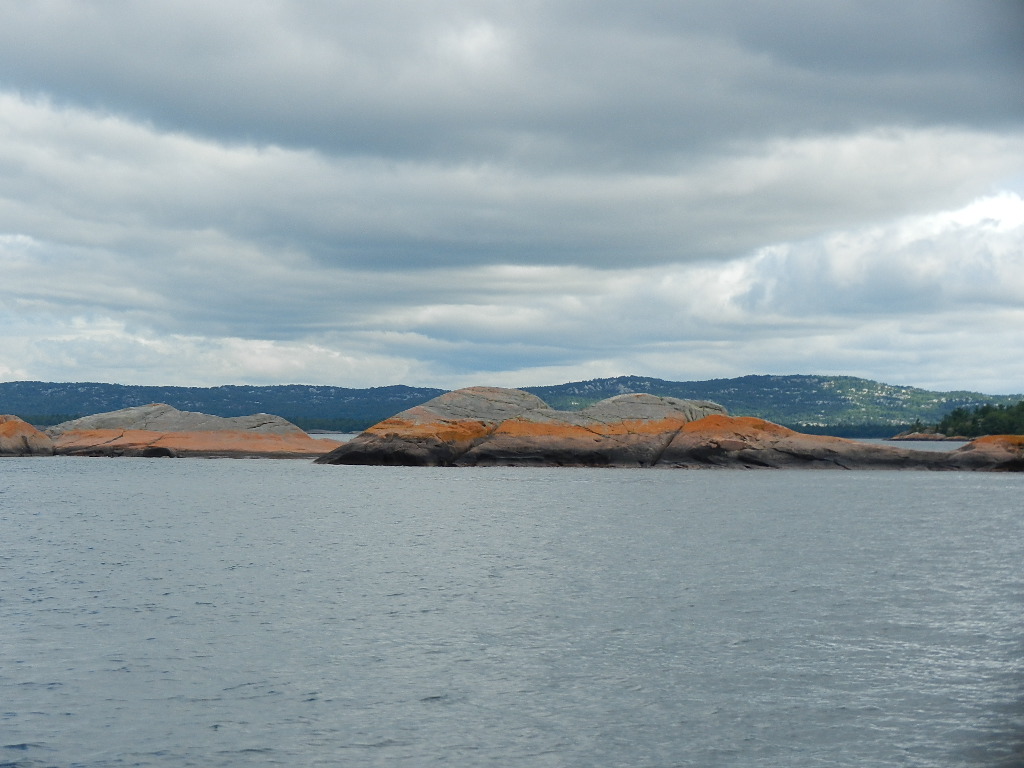
Unique to this area red colored rocks on the approach to The Benjamins

Guided Discovery rafted with Jan's Tern in The Benjamins
When we arrived at 11:35 AM we rafted off with Jan's Tern and joined the for lunch on their boat.  As we ate we debated launching the dingy to visit the island but hesitated due to the rocky shore.  As we were discussing where to land, two people cruised by in a large hard bottomed dingy.  I flagged them down to get a little local knowedge.  Instead we got an invitation to join them in their dingy, with the dogs (Kodi, Daphne and Kaylee), to vist the island.  We also learned that the secret is having a rubber strip on the bow of your hard bottomed dingy.

Jan and Bob on Jan's Tern
Jerry and Lynn, two lovely people, ferried us to shore and joined us on our exploration, which involved walking up the rock hill (approximately 60 feet high and 300 yards long).  Kodi and her friends had a spectacular run up and down the hill.  Unfortunately, Daphne cut her right hind paw when she stepped on something sharp requiring Bob to take her back to the boat for first aid.  The rest of us stayed on the island.

Diana, Lynn and Jan on Benjamin Island
All good things must come to an end.  We departed the Benjamins at 2:20 PM for the 17 mile journey to Gore Bay, a small town further west on Manitoulin Island.  We arrived at the Gore Bay Marina at 3:45 PM. 


Diana and I had dinner at the Cafe on Bay, which overlooks the marina and the bay.  Then we explored the small town.

Cafe on the Bay
Side story: While dining at Cafe on the Bay I asked the waiter about a nice looking facility across the bay that looked like a motel but also appeared to be empty.  I got a strange response.  The waiter said the building was called the Gordon Inn and he could not comment but that I could go on line to get the story.  He also said the the lodge was threatening to sue anyone who made a negative comment.  Just for curiosity sake, I checked the reviews; 33 out of 47 were "terrible"  There were none in the "Excellent or Very Good category.  The narratives were extremely negative.

Written by Les.

Friday, August 10, 2012

Now the North Channel – Killarney to Little Current

Subtitle: A "little" current at Little Current.

We awoke Thursday morning in Killarney with a warning for increasing winds for the next four days (Thursday to Sunday) over Lake Superior, Lake Huron, the Georgian Bay and the North Channel.  The forecast anticipated a low currently to the east  to deepen and move slowly through the area with accompanying winds, rain and thunderstorms. 

Given the forecast and with winds already starting to pick up (NE at 15 MPH), we were faced with a decision.  Stay in Killarney for four days or move on to Little Current, our next destination.  This was an easy decision.  Everyone we’ve met along the Great Loop told us that Little Current was the place to go and it was only a 20 mile run.  Only problem, the Port of Little Current, the most desirable marina,  does not take reservations.  When we called just before leaving they said our chances were good but no guarantees.

We departed Killarney at 10:14 AM and headed west.  Our route took as past several islands that create reasonably protected waters.  That said, with winds at 15 to 20 MPH it does not take much to stir up waves over relatively short distances and there was still a lot of open water.  At different points on the route we experienced a range of seas from flat to 3 foot waves.  Fortunately, the three footers were on the stern (a following sea) and easy to handle.

Little Current is part of Manitoulin Island, the largest fresh water inland in the world.  It is attached to the mainland by the Little Current Swing Bridge, which open for 15 minutes each hour.  We arrived at Little Current at 12:50 PM and were able to get under the bridge which shows a clearance of 18 ft.  We need only 14 feet.  So, no wait.

Strawberry Island Light just outside Little Currect
As we approached the marina it was clear that we would have a challenge.  The good news is that the Port had a 50 feet slip (bow in port tie).  The bad news is that the slip was perpendicular to the wind, which was blowing at 20 MPH and Little Current had a "current" running from the east that was not exactly “little.”

Landing a 50 foot boat in these conditions presents several challenges.   There is the possibility if you lose momentum of being blown into the boat across the slip to the south; there is a possibility of being carried by the current into the boats on the west side of the fairway; and there is a possibility of being blown into the boats on the wall to the south. 

I would like to say that I made it on the first try but that was not the case.   My first three tries involved backing into the fairway so that I could make an upwind up current approach to the slip.  Backing up didn’t work.  Too slow and not enough control.  A bow in entry to the fairway close to the boats on the west side with a pivoting turn to port as we came abreast of the slip and a strong burst of starboard engine power as the boat lined up for entry and 4 marina staff on the dock and perfect line handling by Diana did the trick.  Again the problem here is you basically had to get this right the first time.  A “go around’ (flying language from my past,) while doable, is fraught with problems.

Now we could relax.  Our first act was to go the Anchor Inn (literally 50 yards from the boat) for an alfresco late lunch on the porch.  Now the wind blowing 73 degree water onto shore was our friend.  At lunch we chatted with the Second Officer on the Yorktown, a 260 feet ship that cruises from New York to Chicago during the summer (offerring 7 and 10 day cruises)

MV Yorktown in port at Little Current
Then we met our friends Bob and Jan from Jan’s Tern (45 Tollycraft) and their Wheaton’s, Daphne and Kaylee.  Diana and Jan went shopping while I did a few errands and then joined Bob on Jan’s Tern.


One interesting incident.  While returning Kodi to the boat, I ran into a Canadian Customs and Immigration Officer who was checking to ensure that boats had checked in.  Recall we did that by phone at Trenton after our “fun” crossing of Lake Ontario.  One other small fact, which I didn’t understand when we were given our Report Number.  You’re supposed to post the number on the dock side window.  Good thing I was on the boat.  I showed the officer the number in my log book and she said no problem.  Then she proceed to re-conduct the interview that we had on the phone in Trenton and then wrote a “ticket” and asked me to post it in the window.  She also asked me again about guns, pepper spray and liquor but took me at my word that we had none.  Canada is very laid back.  I have heard that this is clearly not the case when we reenter the US at Drummond Island where you're guilty until proven innocent.

Speaking of laid back.  The Canadian Coast Gaurd rescue boats in trouble.  They do not routinely board boats as the US Coast Gaurd does in Chicago.  Further, during 5,500 mile of travel, we were not boarded by the Coast Guard or police!  That said, while we were in Chicago this summer before leaving for Branford, we were boarded twice on friend's boats.  Further we watched the Coast Gaurd board boats while we were at anchor in the playpen (the gathering place for boats in Chicago).  I don't get it (well maybe I do.  They're probably looking for drunk boaters, which may be more likely around Chicago).

Meanwhile back to the weather.  By Friday, the rain that had been holding south of Little Current most of the day finally moved into our area bringing steady rain.  Checking seas on my Sirius Satellite Weather showed 8 footers on Lake Huron, 6 footers on the Georgian Bay and 3 footers on the North Channel.  Remember, these reading are at the mid-lake buoys.  Downwind from the buoys the waves would be considerably higher as we saw between Point au Baril and Byng Inlet (2 feet versus 4-6 at a distance of 30+ miles from the buoy).

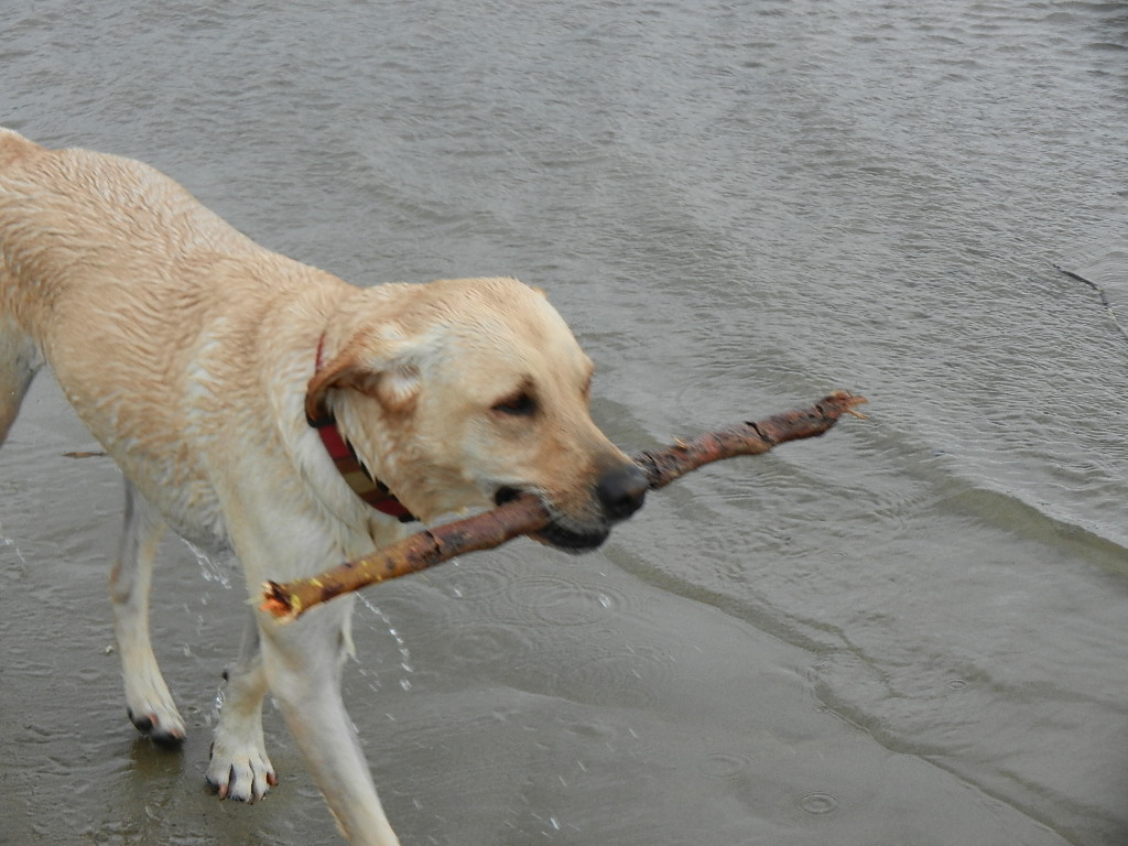
Other fun involved Kodi making friends at the beach with a black poodle who like to run.  Kodi still holds the record.  No dog has every caught her on the run (they only catch her when she runs out of steam).   Kodi also had fun swimming and fetching.


Kodi having a ball
Our custom while visiting new towns is to read the historical signs.  While on our Friday morning walk, we found the remains on an old saw mill founded in 1886.   These signs, and sometime remains (recall the St Johnsville dying factory), show that times change and factories close.  The resultant loss of jobs is a byproduct of progress, which while painfull is not the same as jobs going over seas for lower wages.


Remains of the Red Mill
Note to readers: It's nice to be caught up on the blog for a change.  For most of the trip we've been a bit behind.

Written by Les.

Thursday, August 9, 2012

We finish the Georgian Bay - Byng Inlet to Killarney

Today’s run (Wednesday, 8/8/12) from Byng Inlet to Killarney was absolutely spectacular with the Collins Inlet being the highlight.
We departed Britt Ontario at 8:00 AM with a forecast of 10 MPH winds from the north east.  This was  optimum as we would be running along a lee shore (read as relatively calm water).  We had stayed in Britt an extra day to avoid 15 MPH westerly winds that would have produced a repeat of the 4 to 6 feet waves we had experienced Monday.  Our expectation for today was wave heights of one foot close to shore and two feet within 5 miles of shore.  This proved to be the case.
Today we were traveling with Fred and Julaine from Boreas, a Carver 405 Carver.
Our route took us east down Byng Inlet for the first 40 minutes in perfectly calm water.  As we reached Gereaux Island Light we had a following sea with waves less than one foot.   10 minutes later we turned northwest and headed toward the approach to Collins Inlet some 28 miles away at a speed of 9 MPH.  Approximately 3 hours later we turned north and headed for Beaverstone Bay and Collins Inlet.  During this segment we experienced two foot waves on our starboard beam for about 40 minutes when we reached our furthest point from shore.  Again, an easy run.
Along the way we chatted with Fred and Julaine of the VHF and found out that dockage at the most popular spots (Sportsman’s and Killarny Inn) was all spoken for.  For a moment I was concerned that we may not find dockage – it being high season in this prime cruising area.  However, a call to Roque’s Marina secured dockage for us and our friends.
As we approached Beaverstone Bay we could see a range of black and white mountains to the north.  Once into the bay we saw beautiful rock cliffs and islands with the areas classic windswept pines that characterized this area.
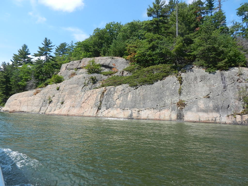
Rock cliffs on Beaverstone Bay
As we approached the hard left turn to Collins Inlet we had to traverse a shallow 200 yard segment with 6 feet of water over granite.  The depth shows as 4.0 feet in the photo below.  That means there is about 2 feet under the props.
Note the depth of 4.0 feet
Collins Inlet runs for approximately five miles.  It is a relatively narrow channel with 15 to 80 foot depths and spectacular natural unspoiled scenery on both sides.  There is very few human habitations.  I’ll let the photos do the talking.

At 2:30 PM we entered Killarney Channel and tied up a Roque’s Marina at the western end of the channel.  Then we went for a walk along the waterfront (all of the action is along the waterfront) and ran into our friends Bob and Jan from Jan’s Tern (45 Tollycraft) who we had met in Penetaguishene.  The had crossed from Tobermory on the south side of the Georgian Bay.  They had experienced high waves for the first 4 hours having been on the windward side when they started their crossing.
Killarney Channel view

Channel view of the fishing fleet

Guided Discovery at Roque’s Marina
View of Sportsman's Inn and Restaurant
Killarney proved to be charming.  It was limited in terms of retail stores (e.g., no supermarket) but had many restaurants.  Most of the commercial is spread out along the road adjacent to the channel.

Convenience store with limited selection

Sportsman's Inn Restaurant
We shared a Heinekin’s on the back of our boat and then had dinner at the Sportsman’s Inn, which proved to be a first class restaurant with a gourmet chef.   All in all a perfect day.

Everyone talks about fish and chips at the red school bus
View of the Killarney Channel from Guided Discovery's cockpit
Georgian Bay Statistics:
  • Total Miles: 200
  • Number of Locks: None - Hurrah
  • Number of Days Enroute: 11 Days
  • Number of Stops: 7
  • Total Fuel Used: 116 Gallons
  • Efficiency 1.72 Miles Per Gallon

Great Loop Statistics as of today at Killarney, ON:
  • 5,501 Total Miles since 10/3/10 
  • 5,382 Total Gallons of Diesel Used
  •      99 Total Locks
  • $3.71   Average Cost of Fuel (up 4 cents)
  • $81      Average Daily Cost of Dockage
  • 413      Days on the Great Loop
  • $217    Average Cost Per Day (unchanged)
Statistics since leaving Branford Connecticut for Phase II:
  • 930    Miles Traveled Since 7/2/12
  • 593    Total Gallons Used (includes sea trial)
  •   72    Locks
Written by Les.