Spectacle Island is located about 6 miles west of Hingham in Boston Harbor. Our first visit in late July was by dingy and was made possible by a relatively calm day. Note: Hingham Shipyard Marina is located in the lower right corner of the map below.
 |
| Spectacle Island as viewed from the east |
Starting in the early 19th century, the island was used exclusively for its relative remoteness from Boston. Two hotels were built in 1847, only to be closed by police ten years later when it was discovered they were used for gambling and other illicit activities.
A horse rendering plant was built on Spectacle Island in 1857, followed by a city trash incinerator that remained active until 1935. When the incinerator closed, trash was simply dumped on the island for the next thirty years. The island remained a smelly, leaking dump until the 1990s.
Then came the Big Dig.
More history. Officially known as the Central Artery/Tunnel Project, it was the most expensive (2.8 billion in 1982) road project in the history of the US that rerouted Interstate 93 (known by locals as "the Southeast Distressway, the world's largest parking lot") and the chief highway through the heart of the city. The project also included the construction of the Ted Williams Tunnel extending Interstate 90 to Logan Airport, the Bunker Hill Memorial Bridge over the Charles River and the Rose Kennedy Greenway in the space vacated by the previous I-93 elevated roadway. The Big Dig transformed the Boston Water front and created a major construction boom in South Boston.
 |
| US National Park Facility |
 |
| Informative displays dealing with the Spectacle Island and the glaciers that formed the Boston Harbor Islands |
 |
| Map showing the walking paths |
 |
| Marina at Spectacle Island with the AB RIB tied to the dock |

On our July visit Lesley, Amelia and I walked up the north drumlin which rises 170 feet above seal level and provides a spectacular view of Logan Airport, South Boston, President Roads (the main channel to Boston Harbor) and the surrounding islands (Thompson, Long and Deer). On a clear day you can see all they way to Salem, which is 16 miles north of Boston.
Beautiful walking paths
 |
| Logan International Airport as viewed from the north drumlin |
 |
| View of South Boston |
 |
| President Roads is the main channel into Boston |
 |
| Looking southeast at the marina from the north drumlin |
 |
| Looking east to the south drumlin |
 |
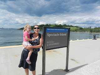
| Lesley and Amelia looking for monarch eggs |
 |
| Lesley and Amelia with Boston to the west |
 |
| The 63 approaching the remnants of the Long Island Bridge Boston is to the left and Spectacle Island is to the right |
 |
| The 63 docked at the Spectacle Island Marina |
 |
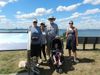
| Darrel Peters & Sue Lister joined us on this journey |
 |
| Along with Diana, Lesley, Amelia and the Furry Kid (Kodi) |
 |
| Looking southeast from the north drumlin at the 63 docked at the marina along with the BHC ferry |
 |
| The crew poses for a photo at the top of the north drumlin with Boston in the background |
 |
| Skip and Jan at the helm on the way to Spectacle Island |
 |
| Lesley and Amelia |
 |
| Mike and Sue joined us with Brady, their 6 year old yellow lab (Kodi's buddy) |
 |
| Diana with Betsy (Dick Singer's sister who lives in Hull) |
 |
| The 63 docked at Spectacle Island Marina as viewed from the south drumlin |


No comments:
Post a Comment