Thursday, May 24, 2018

Northbound 2018: Playing the Weather to Hingham

As noted in the previous article, we arrived the Morehead City Yacht Basin fuel dock at 0815 hours on Wednesday morning. Our goal was to take on fuel, top off our water tank, offload garbage and, since the forecasts looked favorable for following seas all the way to Hingham, wash off the salt. Most important, we wanted to accomplish this in less than two hours. The log shows our departure from the dock at 1005 hours - for a record one hour and fifty minute turn-around - with a wash down. WE DID IT!

Explanatory Note: Why the rush you ask? My philosophy is why sit at a dock when the weather is favorable, as was the case on Wednesday morning. NOAA was indicating continued favorable conditions with a "possible" window all the way to Buzzards Bay. While days down the road, the forecast called high winds and seas for hundreds of miles south of Block Island. This bared monitoring and had the potential to interfere with a direct shot to Buzzards Bay.

We exited the Beaufort / Morehead City Inlet at 1038 hours and headed for Cape Lookout, which we reached at 1240. Then we set a direct course for Diamond Shoal, reaching it at 2020 hours.

This chart includes the Beaufort Inlet, Cape Lookout and Cape Hatteras
The run from Cape Lookout to Cape Hatteras is without a doubt the trickiest stretch of water on our journey as it forces the mariner to go out to sea to avoid Cape Lookout Shoal and Diamond Shoal at Hatteras.  The problem in situations with high winds (and in this area they do not have to be that strong) is that waves get bigger when winds blow over unrestricted distance (fetch) for long periods of time.  So in rough weather one has to hug the coast and then go around the shoals, which in both cases are not cross-able due to a continual shifting bottom caused by storms. This increases the distance to be traveled and the time spent in turbulent seas. In favorable conditions, which represented our situation on Wednesday morning, steering a course directly from Beaufort to the end of Cape Lookout Shoal and from there direct to the Cape Hatteras is my preferred strategy.

Diamond Shoal and the fetch resulting from the Outer Banks being to the east of Pamilco Sound
Explanatory Note: The fetch at Cape Hatteras as measured from the eastern shore of Pamlico Sound  to R2 at the south east end of Diamond Shoal is approximately 35 NM. While not entirely open water, the narrow Outer Banks with a maximum elevation of 55 feet provide little protection from the wind.  Now add the fact that the Gulf Stream's warm water and the Labrador Current's cold water converge at Hatteras and you have a formula for an area that creates its own weather simply by a change in wind and pressure. And then there's the fact that most fronts cross Cape Hatteras. In November of 2014, we experienced a frontal passage in the middle of the night and it was not pretty (i.e., winds to 45 knots and seas 5 to 7 feet). In 2015 owing to Tropical Storm Anna we saw 10 to 12 foot seas as we approached R2.


Our Cape Hatteras log entry at 2020 hours showed winds west southwest at 15 knots with a following seas of 2 to 4 feet. It also showed our distance traveled from Morehead City as 92 NM to R2 at Diamond Shoal. By going direct we had shaved at least 5 hours off the trip.

Rounding Diamond Shoal we set a course for the waters off of Atlantic City some 257 NM north of Cape Hatteras. Weather conditions remained favorable with winds out of the southwest and a following 2 to 3 ft sea, which continued throughout the Thursday night and well into Friday, although seas built to 3 to 5. That said, a following sea for the 63 of less than 8 feet results in a smooth ride.

During the early morning hours of Thursday, while I was on the 1 AM to 4 AM watch, we encountered several cargo ships running north and south on a our course. This does not pose a problem as the 63 is equipped with AIS, radar and night vision.

For example at 0228 hours AIS indicated a Cargo Ship, the Sealand Illinois, 6.9 NM on a bearing of 18 degrees magnetic and the potential of a collision course. AIS allows us to see not only the ship's name but its course, speed, distance from our position and bearing. I called the ship, confirmed that they had us on AIS, and agreed to a port side to port side passing. The Sealand altered course slightly to starboard, which I thought was very sporting of them. I had also identified the Sealand earlier on radar and then visually sited her a 6 NM and finally saw her pass port side to port side on night vision. See photos below.

Cargo Ship Sealand Illinois passing port side to port side

The Sealand Illinois sited on night vision
Cruising on relatively calm seas is a pleasure. At 0700 hours on Thursday morning we were 50 NM southeast of Cape Henry (Virginia Beach) and the Chesapeake Bay in a 3 foot following sea.

Then at 1435 hours we had a little excitement. Two whales off the starboard beam at about 100 yards were cavorting (actually breaching). Truly a Kodak moment, although at 100 yards it was difficult to get a good photo. This was do to the randomness of the breaching and my rather unsophisticated camera. The photo below is the best I could do. This was the first time I had seen a whale in all of my 13,000 nautical miles on cruising on the east coast.

Lower left side - One of two breaching whales spotted on Thursday afternoon
By 1600 hours on Thursday we were offshore 28 NM east of Chincoteague Light, which is on the eastern shore of Virginia some 120 NM north of Virginia Beach. Chincoteague Island is home to National Wildlife Refuge and famous for a breed of horses.

As mentioned earlier, we had been monitoring a vast area of turbulence that encompassed an area hundreds of miles south of Long Island to east passed Cape Cod and well out into the Atlantic Ocean. That area of weather had influenced our decision to head toward Atlantic City from Cape Hatteras rather than head directly to Buzzards Bay.  The forecasted southwest winds would have given us a following sea but with 8 foot waves.

At 1730 hours on Thursday we rechecked the weather for the area in question. As shown in the photo below, the conditions for Friday night called for southwest winds 20 to 25 knots with gusts up to 30 and seas 7 to 10 feet. The forecast indicated slightly improved conditions (i.e., seas 5 to 8 feet) on Saturday morning and beyond.  Our course to Buzzards Bay would have put us squarely in the high seas for most of our trip.


The forecast, however, for the near shore waters along the New Jersey coast was favorable for a run close to shore. We then checked the forecast for Long Island Sound for Friday night. While calling for winds to 20 knots, the seas were forecasted at 2 to 3 feet owing to the protection created by Long Island (or stated another way, not a lot of fetch). Bottom line: Long Island created a barrier making the Sound a lee shore.


Running nearshore to New York and then heading north past the Statue of Liberty and up the East River to Long Island Sound posed a viable and scenically attractive alternative to the forecasted turbulence on the open waters. This route added 35 NM and at least 4 hours to the trip.

One last consideration. All good things come to an end and this would be the case with the Long Island Sound route once we reached Block Island. From Block Island to entrance to Buzzards Bay is open water and subject to the turbulence we were trying to avoid. The forecast (photo below) for Rhode Island Sound shows the same high winds and seas (5 to 8) That said, the time in the open seas would be limited to about 4 hours and we would be heading into improving rather than worsening conditions.


With this in mind we made the decision to head for Sandy Hook (NJ) and either take the Long Island Sound Route or swing due east and run along the southern shore of Long Island if conditions offshore improved.

Now to our progress as we headed north on a straight route to Sandy Hook:
  • Thursday, 2124 hours. South east of Delaware Bay. Winds SW at 20 seas 3 to 5 following. Smooth ride
  • Friday, 0258 hours. Abreast of Atlantic City. Winds SW to 20 seas 4 to 5 following. Smooth ride.
Our log entry at 0258 hours on Friday noted that the forecast showed the possibility of decreased winds and seas along the south coast of Long Island.but with no clear-cut decision to "duck-in" to New York or traverse the south coast.

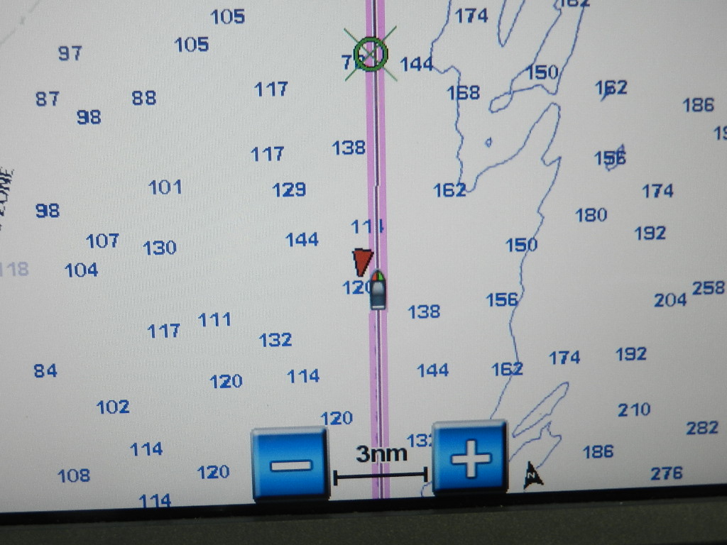
On Friday morning at 1037 hours we were 5 NM southeast of Sandy Hook (see photo below). The weather for the next 12 hours along the south coast of long Island indicated 4 to 6 foot swells and a frontal passage at 2200 hours with winds 20 to 25 knots and gusts to 30 with seas 6 to 8 feet from the (favorable) southwest. We reasoned that the favorable conditions would get us to Montauk Point where we could turn north into Long Island Sound and use Block Island to shelter briefly from the winds. Worst case, we would be exposed to 6 hours of wind driven seas from the west. NOAA indicated a Small Craft Advisory in effect through Saturday noon.

Sirius Sea Conditions show favorable conditions to Montauk Point
We are approaching Sandy Hook New Jersey

Sea Conditions appear to worsen at the 24 hour mark reflecting the frontal passage

The Sea Conditions forecast shows an improving trend at the 36 hour mark
Let's go for it!. At 1049 hours we turned east toward Montauk Point. This resulted in a 3 foot swell off the starboard beam and a very comfortable ride.

We alter course due east for Montauk Point
At 1900 hours on Friday night we were 2.6 NM abreast of Shinnecock Light. We noted winds out of the southwest at 10 to 13 knots with a 3 to 5 foot swell off the starboard aft quarter with an occasional 7 footer. Still a smooth ride.

At 2254 hours we were abreast of Montauk light with southwest winds of 22 knots and 5 to 6 foot seas. From here on the weather behaved as forecasted. As we passed south of Block Island after midnight the winds increased to 25 with gusts to 30 and seas built to the promised 5 to 8 feet with an occasional 10 footer thrown in to hold our attention. We noted that the wind was directly astern with seas off the starboard aft quarter and that the ride was smooth 98% of the time.

You can see the narrow nearshore corridor that allowed us to reach Buzzards Bay favorable sea

A dry cold front approaches as we reach Buzzards Bay
As we approached Buzzards Bay in the early morning hours of Saturday we saw winds and seas begin to diminish recording 4 to 6s at Buzzard Bay Light. Most of the ride up Buzzards Bay was in 2 to 3 foot seas.

Around 0700 hours on Saturday we arrived at the west (south) entrance of Cape Cod Canal and immediately experienced a drop in speed due to a 2.0 knot current from the north. Further slowing our transit of the canal was the movement of a large barge. Canal control asked us to wait to allow the barge to pass.

We wait as the barge maneuvers into the center of the canal 
We exited the canal at 0826 hours and headed north into Cape Cod Bay in 2 foot seas reaching Boston Light at 1318 hours.

Boston Light at the entrance to Nantasket Roads
48 minutes later at 1406 hours we were docked at our berth on the face dock of I-dock. The 9th "snowbird" transition was successfully completed. Further, this marked the third trip in a row with extremely favorable weather.

MOREHEAD CITY to HINGHAM
  • Departure: Wednesday May 2 at 1005 hours (From Morehead City)
  • Arrival Hingham: Saturday May 5 at 1406 hours
  • Total Distance Morehead City to Hingham: 642 NM
  • Distance since Sarasota: 1,529 NM
  • Average Speed 8.5 knots
  • Total Engine Hours: 76
  • Engine Fuel Used: 688 gallons
  • Generator Fuel Used: 79 gallons
  • Total Fuel Used: 767 gallons
  • Fuel Added: None
  • Estimated Fuel Cost: $2,301.00 (based on $3.00 per gallon)
TOTAL TRIP - SARASOTA to HINGHAM
  • Departure from Marina Jack: April 27 at 1221 hours
  • Arrival at Hingham: May 5 at 1406 hours
  • Total Time Enroute: 9 days and 2 hours
  • Total Engine Hours: 163
  • Total Distance: 1,503 Nautical Miles
  • Engine Fuel Used: 1,651 gallons
  • Efficiency: .91 NMPG
  • Generator Fuel Used: 192 gallons
  • Total Fuel Used: 1,743 gallons
  • Total Overall Cost: $7,395.94


Saturday, May 19, 2018

Northbound 2018: Express to Morehead City

As noted in the previous article, we departed Venice at 1140 hours on Saturday. Our goal was a fuel stop in Morehead City North Carolina, which is approximately 900 NM from Sarasota.

By early Sunday morning we were off Everglades National Park when we fixed our position. We noted that the wind and seas were diminishing and that this was favorable for the shallow water approaching the Seven Mile Bridge at Marathon.  We had traveled 130 NM from Venice and 163 NM from Sarasota.

At 0715 hours we crossed under the Seven Mile Bridge in calm seas and headed out beyond the reef to pick up the Gulf Stream.

Approaching the Seven Mile Bridge at Marathon


The bridge and causeway viewed through FLIR night vision

Three views of the opening at the Seven Mile Bridge
Through the window, on our night vision screen and on radar
At 1326 on Sunday we were 8 NM southeast of Key Largo with seas of less than 1 foot. We noted in the log that it "does not get any better than this." A review of the forecast showed that we had a weather window to Cape Hatteras (now three days away) with 3 foot waves along the Florida Atlantic coast.

The photo below shows all good news on our two Garmin GMI 10 instruments. The one to port indicates a current speed of 10.9 knots, an average speed of 8.8 knots since leaving Venice. We had covered 243 NM since Venice and 250.1 NM since leaving Sarasota. The instrument to starboard shows a 4.3 knot wind out of the southwest with a temperature of 81.5 degrees and a steady barometer at 30.10 inches. Remember, the 63 Outer Reef's cruise speed is 8.4 knots. Like I said, it does not get any better than this.

Speed and weather instrument readings in the vicinity of Key Largo
At 1805 we were 5 NM off the Miami Inlet showing an average speed of 9.0 knots thanks to the Gulf Stream. We made a decision to continue north in the Gulf Stream. That decision would cause us to be 40 NM offshore as we passed Cape Canaveral sand close to 100 by the time we reached the Florida Georgia border. At this point we were 303 NM from Sarasota.

Just north of the Miami Inlet  our speed is 10.2 knots and we are in 373 feet of water
Note the AIS return of the vessel just southeast of our position
At midnight on Monday off Palm Beach we observed a current speed of 10 knots and noted that our average speed had increased from 8.7 knots to 9.2 knots in the past 13 hours. Seas were 3 to 4 off the starboard bow owing to 16 knot wind from the east southeast. We noted that forecasted winds and seas were behaving as predicted and that we were experiencing a smooth ride even in the head sea. We calculated 873 gallons of fuel remaining.

At 0700 hours we were 29 NM east northeast of Vero Beach showing an average speed of 9.3 knots. The Gulf Stream had added 9/10ths of a knot to our speed since leaving Venice. We noted that winds had increased to 18 knots and were still out of the east  northeast and that seas were under three feet. Needless to say we were experiencing a smooth ride. We noted 497 gallons of fuel consumed, 457 by the engines and 40 by the generators.

That changed as we approached Cape Canaveral at 40 NM offshore. The winds by mid-morning had picked up to 22 knots out of the east northeast and this increased wave heights off our bow to 4 to 6 feet with an occasional 8 footer. We estimated the wave period at 4 seconds (wind driven and rough) and noted that the winds were substantially higher than the forecasted 10 to 15 knots. We were now experiencing 15 to 25 knots. This resulted in rougher ride and a bit of spray as we cut through the waves. This situation continued until late Monday afternoon.

At 1500 hours I began a fuel transfer operation that moved approximately 270 gallons from the auxiliary fuel tanks located in the lazarette. This was necessary as the auxiliary tanks are not plumbed into the engines. Given the combination of engine and generator fuel consumption we would not have enough fuel to reach Morehead City using the 1,000 gallons of fuel in the main tanks. Morehead City is approximately 900 NM or 1,045 statute miles from Sarasota. The 63 uses 1 gallon of fuel for every statute mile while running at 8.4 knots (9.7 statute mile per hour). Therefore, even without generator usage we would run out of fuel without the transfer. The entire transfer process took an hour and 45 minutes and went smoothly.

At 1700 hours on Monday afternoon we were 80 NM east of St Augustine and still in the Gulf Stream. Winds were still out of the east northeast but had diminished to 17 knots with a commensurate drop in wave height. We estimated seas as 3 to 5 foot and noted a "reasonably smooth ride."

One hour short of midnight on Monday we noted that we were 95 NM due east of Jacksonville "flying" along at 9.5 knots. Winds were now out of the east at 8 to 12 and seas had dropped to 3 to 4 feet. Our comment reads "finally a smooth ride after a day of occasional 8 footers on the nose." We noted 597 gallons remaining to cover a distance of 296 NM to Morehead City. That represents a very comfortable reserve.

Two hours later (0146), on Tuesday Morning May 1, we were 102 NM east of the St Mary's River (i.e., Fernandina Beach and the Georgia border) with 2 to 3 foot seas.

At 0730 on Tuesday morning we were 88 NM east southeast of Charleston SC and continuing to get a boost from the Gulf Stream. Our average speed was now 9.6 knots. Winds had shifted to south southeast and had diminished to 4 knots. The calming winds resulted in calm sea. The photo below shows our position. The blue color reflects the favorable sea conditions.

Almost 100 NM off Charleston SC.

Off of Charleston we show a drop in current speed to 8.7 knots even though our average speed holds at 9.6 knots.
At 1427 on Tuesday afternoon we observed a reduction is current speed to 7.0 knots for approximately a half hour. We attributed this to a "backwater" current which was visible on the Sirius Satellite Weather "Fishing" screen, which indicates water temperature. We had entered a segment with cooler temperatures. We altered course to more quickly exit the Gulf Stream by heading direct to the Morehead City Inlet and increased RPMs to 1,500. This produced a speed increase to 7.6 knots and a 5 NM reduction in distance. Note: The speed increase and the distance reduction to not offset the extra fuel consumption which jumped from 9.1 GPH to 11.6 GPH. We soon cut that back to 1,400.

As readers of this blog may recall, we record a log entry every 4 to 6 hours and generally perform an engine room check at the same time. Below, is the entry for late Tuesday afternoon at 1704 hours.

  • Direct to Waypoint 0856 at the Morehead City Inlet
  • Location: 122 NM south southwest of Morehead City Inlet
  • Current speed 7.8 knots. Average Speed 9.5 knots (since Venice)
  • Wind WSW at 8 to 10 knots
  • Barometer 30.32 (very high pressure)
  • Distance: 763 NM from Sarasota
  • RPMs: 1,500
  • Fuel Used: 821 gallons engine plus 90 gallons generator. 911 gallons
  • Seas less than 1 foot off the port aft quarter.
  • Location: Latiude N 32 degrees 51 minutes. Longitude W  077 degrees 45 minutes
  • Comment: Sea conditions for the last 10 hours were perfect calm. ETS Morehead City inlet at 0850 hours. Forecasted conditions for traversing Cape Hatteras and on to Virginia Beach show favorable seas of 2 to 3 feet. Past Virginia Beach open water shows following 5 to 8 foot seas seas with southwest winds 15 to 20 knots. Conditions are favorable for a nearshore run and may be OK for direct line to Buzzards Bay Massachusetts.
Needless to say we were all very relaxed and took advantage of conditions to catch up on the news.


Morgan appears to be very comfortable

And so is David
On Wednesday morning at 0747 hours we entered the Morehead City Inlet and 28 minutes later we were tied up at the Morehead City Yacht Basin fuel dock. We had made it to Morehead City in slightly less than 4 days. Key statistics below:

SARASOTA TO MOREHEAD CITY
  • Departure: Saturday March 28 at 1140 hours (From Venice)
  • Arrival: Wednesday May 2 at 0815 hours
  • Total Distance Sarasota to Morehead City: 886 NM
  • Distance since Venice: 861 NM
  • Average Speed 9.4 knots (Since Venice)
  • Total Engine Hours: 97
  • Engine Fuel Used: 963 gallons (Since Sarasota)
  • Generator Fuel Used: 113 gallons (Since Sarasota
  • Total Fuel Used: 1076 gallons (Since Sarasota)
  • Fuel Added: 1018.4 gallons
  • Fuel Consumption Error: 58 gallons or 6% (over estimate - a good thing)
  • Price per gallon: $2.81 before tax. $2.9996 with tax
  • Fuel Cost: $3,054.86

Northbound 2018: Overheat Alarm Out of the Gate

Reader Note: This blog has been silent since the last trip south from Hinghan to Sarasota, which, incidentally, set what I believe will be an all-time record for cooperative weather and running time (i.e., 7 days and 7 hours).  My lack of activity resulted from being heavily involved in editing my daughter, Lesley's, doctoral dissertation and a bit of laziness. Lesley successfully defended her dissertation in March and graduated from Northeastern University' College of Professional Studies with an Ed.D on May 10th.

Now to our story. As usual, the process of transitioning our residence from Sarasota to Hingham involves preparation including crew, maintenance, food, weather and, most critical for this trip, the route out of Sarasota Bay.

The crew decision came early in December when Morgan Watt decided to do another journey. Morgan crewed with me in 2017 with Guy Aries so this would be his second time. Morgan is eminently qualified as second in command as he has both a pilot's and captain's license. Morgan flew jets for NetJets for 17 years. Needless to say, he brings considerable experience with navigation, communication and weather. Morgan nominated his father, David, as the third member of our crew. David too has boating experience and has taught boating safety classes.

David Watt, Morgan Watt and myself at departure.
My friend, Jim Lampl, in the background came to see us off
Food for the journey north is a "no brainer." Morton's Gourmet Market provides prepared entrees, called "Gourmet Meals To Go,"and their executive chef, Fernando, prepared some special dishes including mushroom ravioli; Dijon chicken with fingerling potatoes and Brussell sprouts; and chicken pico degallo with fingerling potatoes and green beans. Add to this their standard fare including grilled salmon, meatloaf and mashed potatoes, veal cannaloni and eggplant rollatini and you have the makings of gourmet meals. The rest of the provisioning process is outlined on an Excel worksheet. The key to provisioning is to have food for 9 days. That requires 27 dinner entrees which are frozen and stored in the freezer. When we depart Sarasota or Hingham the freezer and refrigerators are stocked close to capacity. Fortunately, the 63 has a full size GE Monogram side by side refrigerator.

Maintenance. Dealing with repairs and maintenance during the winter of 2018 in Sarasota proved to be an exercise in frustration and considerable expense. Needless to say, almost every repair required multiple visits by my service personnel. They literally could not fix anything it right the first time. I may treat this a separate blog article, perhaps as a way of venting my frustration. We finally finished all maintenance and repair tasks on day before departure.

Now to weather. As of Friday morning at 10:45 AM we had favorable conditions all the way to Cape Hatteras. Winds off the Florida Keys were forecasted to be around 10 knots with seas 2 to 3 feet on Saturday. Heading north off Cape Canaveral the forecast called for north winds 10 to 15 with 2 to 3 feet seas on Sunday. Farther north on Monday, at Jekyll Island Georgia, NOAA was calling for east north east at 10 to 15 knots with seas 3 to 4 feet. Waters off Cape Fear on Tuesday showed winds less than 10 knots and seas 2 to 4 feet. Finally at Cape Hatteras they were calling for west winds 10 to 20 with seas 3 to 6, which for us would be mostly a following sea.

The "big picture" on Friday morning showed calm weather in the southeastern US

The next important decision is how to depart from Sarasota Bay. This decision involves tides, winds and seas. The easiest way is via Sarasota Big Pass. But this route comes with a tricky ever shifting shoal at the mouth of the pass. The slowest and safest way is south on the Gulf Intracoastal Waterway (GICW) to Venice. This route, however, involves four (4) bridges and several no wake zones.

This year I chose to map the route through the Big Pass shoal by following the fishing party boat on on its daily run out to the Gulf fishing grounds. My AB RIB is equipped with a depth sounder and Garmin Chartplotter. What I found was a controlling depth (i.e., the shallowest spot) of 6 feet. This strongly suggested that the best time to traverse the route was at high tide. "High tide" in Sarasota adds 2 feet of clearance. So, at the shallowest spot we would have 3 feet of clearance. The high occurred on Friday, August 27, at noon time and that fact and the forecasted seas of 2 feet of less dictated our departure time.

The crew arrived on Friday, April 27 at 11:45 AM and by 12:21 PM we were on our way. At 12:51 , one hour after high tide, we traversed Big Pass. Seas were less than a foot, largely to due to protection of the 2 mile sand bar to the west. Our depth sounders lowest reading on the planned course was 1.5 feet. We were now successfully in the Gulf and headed south.

Around 14:00 I noted an alarm on the stabilizer control panel that read as follows"High Oil Temperature / Warning Only / Check Cooling System."  This alarm indicated that the hydraulic fluid was overheating. This is a precursor to a full overheat would could damage the system. Catching it early was good news. The bad news is we had to shut down the stabilizers and would not be able to continue the voyage until the problem was resolved.

Fortunately, winds out of the northwest at 10 to 15 and seas under 2 feet were favorable to a complete shut down of both engines. Now adrift approximately 5 NM south west of Venice, Morgan and I began to process of trouble shooting the problem. We immediately noted no water flow at site glass and that hydraulic fluid level was full.  This indicated a blockage somewhere in the cooling system.

Fortunately we were also within cell phone range. This facilitated contact with Randy Ives, Outer Reef's Warranty Manager, and Robert from ABT TRAC, who at the time was located in the United Kingdom. We decided to work with Robert since he was the expert.

We first checked the sea strainer basket. It was clear and this was no surprise and I had verified that all six sea strainers were clean the day before departure. With the sea strainer cap off we opened the through hull fitting and verified the water was flowing freely. We then removed the hose leading from the sea strainer to the impeller. It was clear. We then removed a housing at the impeller and checked that the impeller was spinning. Then we verified water flow from the impeller to the site glass. Water was flowing up to the site glass and this suggested a blockage in the head exchanger.  We then removed the zincs from the heat exchanger and noted that the lower zinc was broken off from the plug and jammed in the hole. The broken zinc was a problem but not sufficient enough to block the water flow.


Hydraulic System site glass and heat exchanger

Hydraulic system impeller pump
At this point we had narrowed the blockage to the heat exchanger. If this were the case, we would need, at a minimum, a mixture of hydrochloric acid and water to clean the strainer. Unfortunately we had none aboard. We decided to head for Venice and called the Crows Nest Restaurant for dockage, which was available. The Crows Nest is located just inside the Venice Inlet.

Guided Discovery at the Crow's Nest
Venice was approximately 5 NM to the northeast and we headed for the inlet. This put the seas, which had build 2 to 3 feet, on the port side. As we traveled northeast we noted that engine bilge light on the annunciator panel (over the helm) was indicating that the bilge pump was operating. We appeared to be taking on water. Sure enough, that was the case. I discovered that the port side engine room port hole was open. Worse, the 24 volt battery charger that sits just aft of the port hole has shorted out due to salt water entering through the cooling vents (a $1,300 loss). I have never opened any port holes. Hence checking for open portholes is not on my Engine Room Checklist.

I surmised that when Master's Touch Marine Services technician, Joey, replaced the 220 volt ISO Boost transformer he had left the port hole opened. I then notified Master's Touch's owner, Jeff Quattlebaum, of the error only to learn that Jeff, himself had opened the port hole when he was painting the 16KW generator. Jeff forgot to close it.

He then refused to take responsibility.  First he claimed that it was my responsibility to check for an open porthole. I showed him the engine Room Check list and pointed out that checking for open portholes in not part of my procedure as I do not open the engine portholes or any portholes for that matter. Then he claimed that he verbally had told me that the window was open, which was blatantly untrue.

I found Jeff’s response to the problem regrettable on several counts. The most troubling was that he had driven to Venice to address a problem with my hydraulic heat exchanger (although he was planning to be there anyhow). As a concession, he agreed not to charge me for the trip to Venice and the 90 minutes to clean the heat exchanger. Unfortunately, the cost of replacing the MasterVolt charger was $1,315, which is what Jeff charged me a rear sgo when he replaced the same unit as the result of an internal failure. However, he also terminated our service relationship and threatened that I would not be able to get service in the future from Marina Jack Services. I found the whole transaction totally unacceptable.

This was not the first time that Jeff’s was careless. During a repair to a hydraulic leak at my stern thruster in December 2016 he mistakenly shut off my hydraulic steering ball valve located immediately above the thruster to stop the flow of hydraulic fluid. It did not stop the release of fluid as the two systems are unrelated. Unfortunately, he did not reopen the valve. The result was that weeks later I pulled out of my slip only to discover I had no steering. Fortunately I was able to return to my slip using engines and thrusters. Had I damaged another boat we would have had a serious legal problem related to Jeff’s negligence.

Doing business with Jeff has always been a bit of a challenge. He does not answer his phone and does not communicate. That said, Jeff has done many projects successfully and I regret that we will not continue working together. 

As noted above Jeff fixed the problem (by pouring acid into the heat exchanger) and by 11:40 AM on Saturday we were on our way.

Bottom line: We had lost a full day.


Explanatory Note: