 |
| Contrail viewed on Monday morning |
We never miss an opportunity to lock through without a wait. So, off we went at 6:58 AM and by 7:33 we had departed Coffeeville, our final lock. Coffeeville's 34 foot drop (lift) put us at sea level. We had now descended 590 feet since leaving Chicago.
We had discussed cruising 66 miles to an anchorage called Bashi Creek, staying overnight and making the remainder of the 135 mile trip on Tuesday. Then, shortly after exiting the lock and cruising at 10 MPH, we said "what the heck, the weather good, it's early, we have plenty of time, let's go for Mobile." Essentially, I/we had become addicted to the thrill of moving the boat at speed.
Besides, Fred Myers, author of the Nitty Gritty Tenn Tom, said that there was not much to see on Lower Black Warrior Tombigbee. He was right. But it does make a great setting for a fast run.
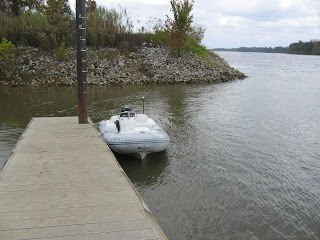
In addition to the buoys, the tows and the debris, the only other challenge we faced was attending to Kodi's needs. We decided that we would try to stop midway. As we passed the juncture of the Alabama River just before noon we spotted a boat launch ramp with a dock on the right descending bank, pulled over to shallow water on the left bank, dropped anchor and launched the dingy and took Kodi to shore. The whole process took an hour and by 12:40 we were on our way.
 |
| Docks at launch ramps mean not having to get wet and muddy |
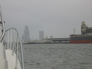
By 2:46 we had reached the beginning of Mobile Harbor, which is entirely industrial. According to Fred Myers, its the 12th busiest commercial harbor in the US. Unfortunately, just before we arrived it started to rain quite heavily. Finally, at 3:05 PM we reached mile marker 0.0 on the Lower Black Warrior Tombigbee River.
 |
| The Mobile Civic Center, Mile Marker 0.0 |
Here are a few photos of Mobile Harbor.
Mobile's ship channel took us south where we turned right between green day marks 65 and 63 into the channel to Dog River. This channel, which is marked with red and green day markers, is 100 feet wide and 7 feet deep. As we ran the channel our depth sounder indicated 4.5 to 5 feet of water.
 |
| Leaving downtown and entering the ship channel |
Note: A day mark looks like a sign on a telephone pole sitting out in the middle of the water.
We arrived at Dog River Marina at 4:30 PM, after running for almost nine hours (8:37 to be precise). Since 6;58 AM we had covered 135.1 miles at an average speed of 15.6 MPH. The engine management system said we had burned 158.7 gallons of fuel.
We topped of the tanks at Dog River taking on 317 gallons at $2.98 per gallon, the most fuel we bought and the lowest price we paid since starting the trip. The bill was $943.17. Since leaving Demopolis we had covered 230 miles and averaged 0.73 miles per gallon. Not particularly efficient but great fun.
We were invited to a looper cocktail party on the boat just across from us. At the party were Bill and Debbie and Ted and Pam (Patience Patience) who we had met at Grand Harbor, Ed and Gayle, who we traveled with today and several new friend, Louise and Louis, Jean Louis and his lovely wife who were all from France.
 |
| Our hosts in the foreground, Louis, Gaylle and Diana |
 |
| Louise, Jean Louis and Wife, Pam and Ted |
We had decided to go to dinner with Ed and Gayle at a restaurant just 200 feet across the channel from the marina. To reach it on foot or by car required traveling over three miles across a bridge. We took the short cut and dingied across.
 |
| The restaurant was in the gray building to the left |
Written by Les.


Salt water! Have you checked your zincs lately?
ReplyDeleteReally, there are things to see and do in Mobile, not least of which is to visit the USS Alabama. We have a friend who spent an entire day there and wanted to go back the next day. Of course, he is a bit over the top when it comes to battleships. We spent a few hours there, and Rick's attention span for these things is not long.