Peddocks lies across Hull Gut and the Pemberton neighborhood of Hull to the north and across West Gut to Nut Island and Hough's Neck to the west. The island is one of the larger islands in Boston Harbor at 210.4 acres and has the longest island shoreline. Peddocks Island comprises four headlands connected by gravel or sand bars known as tombolos.
 |
| Peddocks Island looking northeast into Hull Bay Hull Gut is to the left. The West Gut and Hough's Neck is to the right |
 |
| Looking east across Hull Gut to Pemberton Point |
In 1904, Fort Andrews was built on the island, and it served as an active harbor defense fort until the end of WWII. As of 2008, 26 of the original buildings of Fort Andrews were still standing — guardhouses, prisoner-of-war barracks, stables, a gymnasium, a firehouse, etc. — although most of them were in decrepit shape and were closed to the public for safety reasons.
It is still inhabited today although by only 17 people. The island has no electricity or running water. We met one of the residents and he told us that theState of Massachusetts had deliberately destroyed a water main that ran to the island from Hough's Neck in an attempt to force residents off the island. According to his account, the State nearly succeeded but was prevented from evicting the residents due to the manner in which titled had been conveyed to the properties.
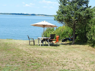
Lesley, Amelia and I walked from one end of the island to the other by the central path that connects the headlands. Then we walked back along the northeast shoreline. In total we walked over 3 miles. I'll let the photos tell the story.
 |
| A building from Fort Andrews with parade field to the left |
 |
| A photo showing a now demolished building and the one in the above photo |
 |
| Our dingy anchored off the ferry dock |
 |
| Stairs leading to a camp ground on the drumlin |
 |
| Cicada |
 |
| One of the houses on the island |
 |
| View of the west headland with cottages visibile |
 |
| Houses on the west side of the islands. Some in very good shape |
 |
| Yes, they really have out houses. No running water |
 |
| Long abandoned cottage |
 |
| Rain barrel to collect water |
 |
| Remnants of a dock |
 |
| One of the island's 17 residents |
 |
| View of the Ranger station |
 |
| National Park Service Rangers |
 |
| Historic photos |
 |
| Lesley captures me pulling up the anchor |
Written by Les.


No comments:
Post a Comment